Monday, 18 July 2022

Fraserburgh and Portsoy: Scotland '22 Part 4

Lighthouses and a Salmon Bothy

Setting the Scene


Scotland
Moray
After driving north from Glasgow we spent the next week in a borrowed cottage (thank you Jenny and Bob) in the delightful fishing village of Findochty, pronounced (for no obvious reason) ‘Finechty’, beside the Moray Firth. During our week we travelled west as far as Culloden, east as far as Scotland goes, south to Huntly and Fyvie and north to the harbour wall. This post is about the journey east to Fraserburgh.
Our travels around Findochty fit neatly into the red oval

Findochty to Fraserburgh

Findochty to Fraseburgh is 54km (33miles) as the crow flies, but as almost the whole route would be over water, it is strictly a bird route. The A98 makes a dip to the south pushing the distance up to 69km (43miles). It makes the driving easier, but I tapped ‘shortest’ rather than ‘recommended’ to make life more interesting.

Moray and Aberdeen

Aberdeenshire
Findochty is too small to appear on the map above but it lies on the coast between Buckie and Cullen. Beyond Cullen we left Moray and entered the ‘council district’ of Aberdeenshire.

The A98 took us to Portsoy (of which more later) and from there our sat nav selected a direct approach to Banff along the B9139. The extraordinarily narrow road ran across flat farm land, with a view of the sea to the left – or so I am told, I kept my eyes on the road. We saved about 1km on an 8km journey, but it took longer and the breaking and accelerating probably used more fuel.

Banff and Macduff (they have their own post here) are small towns either side of the mouth of the River Deveron. Until the 1975 reorganisation, Banff was the county town of Banffshire. The coast of Banffshire ran from west of Buckie to Gardenstown, while the hinterland straggled southwest in the shape of a carelessly wrung out floorcloth. It is now divided between Moray and Aberdeenshire.

The B9031 from Macduff to Fraserburgh is pleasant road that cuts off the southern loop of the A98, but introduces plenty of smaller digressions of its own. The road runs mostly through farmland on a plateau some 100m above the coastal strip but at Pennan it descends to the harbour. Half a mile before the village the road drops steeply out of view suggesting that if you put your foot down hard you would take off and soar serenely out to the sea. Actually, you wouldn’t.

Fraserburgh and The Museum of Scottish Lighthouses

We drove through Fraserburgh to our destination, Kinnaird Head on the north east corner of the town and a candidate for the most north-easterly point in Scotland. Scotland’s particular shape provides a second candidate, Duncansby Head near John o’ Groats which is much further north but nowhere near so far east. As there is no definition of ‘most north-easterly’, it’s your choice.

The award winning Fraserburgh Heritage Centre would have been worth a visit, but unfortunately Storm Arwen removed the roof in November 2019. The volunteers who run the Heritage Society still seem to be active online, but there is as yet no sign of a re-opening, or re-roofing.

Fraserburgh Heritage Centre

On the same site is the rather better roofed Fraserburgh Museum of Scottish Lighthouses. We popped through the Hobbit hole to buy tickets, then popped out again and walked round the back.

Museum of Scottish Lighthouses, Fraserburgh

It is a reasonable possibility that a lighthouse museum might contain a lighthouse, but not inside the building, obviously. The Kinnaird Head Lighthouse, round the back, is a remarkable, possibly unique example.

Kinnaird Head Castle and Lighthouse

Sir Alexander Fraser, 8th laird of Philorth, an area to the south of the modern town, built himself a castle on Kinnaird Head in 1570. Nine years later he built a port nearby and in 1588 he obtained a charter establishing it as a 'burgh of barony'. His building works having combined the villages of Faithlie and Broadsea, he successfully sought the right to rename the newly created town Fraserburgh.

One Fraser or another lived in the castle until they ran out of Frasers in 1764. In 1787 the building was leased to the Northern Lighthouse Board which had been set up ten years earlier to improve safety at sea. Thomas Smith, the board’s first chief engineer set a whale oil lantern backed by an array of parabolic reflectors on the castle tower. The most powerful light of its day it, was visible from as much as 22km.

In 1824 Robert Stevenson erected a new lighthouse tower within the castle with a new improved lantern and reflector array.

Robert Stevenson was the stepson and former apprentice of Thomas Smith. He built 18 lighthouses in his career, the most remarkable being the Bell Rock Lighthouse, 11km east of the Firth of Tay and the oldest sea-washed lighthouse still standing. He also spawned a dynasty of lighthouse engineers, the family tree being set out in the adjacent museum.

The Stevenson family

Alan Stevenson, installed a first order dioptric lens at Kinnaird Head in 1851. The first purpose-built accommodation blocks were designed by David and Thomas Stevenson in 1853. In 1902 David Alan Stevenson installed a flashing lens apparatus designed by himself and his brother Charles Alexander Stevenson that was visible form 40km away. The black sheep of the family was Robert Louis Stevenson, author of Treasure Island, Kidnapped and more, but he was as successful in his chosen career as the rest of the family were in theirs.

I also learned not to confuse Robert Stevenson with Robert Stephenson, member of another dynasty of engineers, but railway rather than lighthouse focussed. Robert Stephenson was busy building ‘Stephenson’s Rocket’ when Robert Stevenson was industriously constructing Tarbert Ness lighthouse.

Climbing the stairs of Robert Stevenson’s new tower….

Climbing Stevenson new tower, Kinnaird Head lighthouse

….we dropped in on the keeper’s room, looking untouched since the 1970s. There was always a duty keeper in case of emergency and, in the early days, to carry the oil up the stairs and replenish the tanks.

Keeper's accommodation, Kinnaird Head lighthouse

Emerging on the roof of the castle…

On the roof of Kinnaird Head Castle

…there is a good view over the town of Fraserburgh…

Fraserburgh

…and over the docks. Fraserburgh is a major fishing port, the largest shellfish port in the UK and one of the largest in Europe.

Fraserburgh fishing port

You can also look down on the modern lighthouse, which does not need a fulltime keeper, and the now redundant foghorn.

The modern Kinnaird Head lighthouse

Back inside the lighthouse, we inspected the business end…
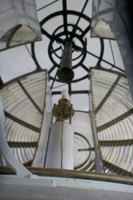
The business end of Kinnaird Head lighthouse

…before descending the steps to see the Kelvin diesel engines installed in 1950, replacing the earlier paraffin fuelled engines which had replaced the youngest keeper manhandling the fuel up the stairs.

Kelvin 44-HP diesel engines

Outside we had a look at the Stevenson designed keeper’s accommodation…

Stevenson designed keeper's accommodation, Kinnaird Head

…and then made our way into the museum itself. The Kinnaird Head lighthouse was by far the most interesting part of the museum. Inside, the display of lenses and reflectors would have been interesting to the specialist, but apart from the pleasing shapes, meant little to the average lighthouse ignoramus like me. On the other hand, I always appreciate photographs of lighthouses standing on lone wave-lashed rocks way out to sea.

Fraserburgh Lighthouse Museum

Lunchtime arrived so we dropped in to the museum café. The chicken stuck between two slabs of bread had been freshly cooked, not taken from a packet and pinged in a microwave. That earned a bonus point.

Record Temperatures

Driving back west, the brilliant sunshine displayed the coastline at its best.
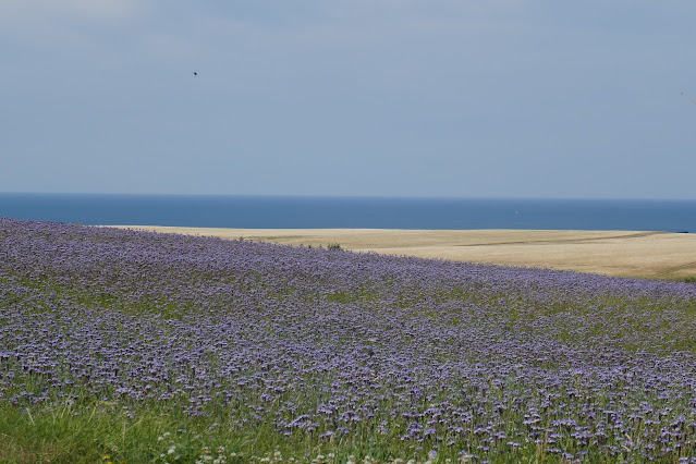
Driving west from Fraserburgh

It had been breezy up the lighthouse, Kinnaird Head Lighthouse holds the record for the UK’s highest ever low-altitude wind speed (142 mph (229 km/h) in February 1989) and it was not until we stopped for fuel at a less exposed location that we realised how warm it was. The 18th and 19th of July 2022 saw temperature records set in Scotland, Wales and England. Coningsby in Lincolnshire recorded a toasty 40.3°C, while Charterhill in the Scottish Borders set a more modest Scottish record of 34.8. Beside the Moray Firth, some 230 km further north, it was, of course, cooler, the temperature gauge in my car read a steady 28°, though for some reason the Met. Office does not accept that as an official record.

Portsoy and its Salmon Bothy

Portsoy is bigger than most surrounding villages with a well-defined centre. Leaving the main road we descended towards the picturesque harbour nestling at the base of a small headland. The harbour has enjoyed something of a showbusiness career, appearing in Peaky Blinders and starring in the 2016 remake of Whisky Galore!
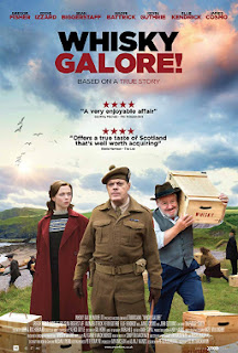
Whisky Galore!

There was a DVD of Whisky Galore! in our borrowed cottage, so we watched it one evening. During WW2, when whisky is rationed, a ship carrying 50,000 cases of Scotch runs aground off the fictional island of Todday. The customs officer, the home guard, the police and the islanders all have their own ideas about what should happen next. Compton Mackenzie’s novel was written in 1947 and he wrote the screen play for the 1949 film which puts the 2016 version at a disadvantage, but the setting is beautiful photographed, the cast led by Gregor Fisher and Eddy Izzard seem to have enjoyed making it and we enjoyed watching it. It had mixed reviews; I understand why it did not go well in America, but the British reviewer who described the film as Too restrained and polite to really grip the attention missed the whole point. There are no real villains, there is no shooting, no loud explosions, no special effects, but who needs them?

Round the other side of the headland is Links Bay…

Links Bay, Portsoy

…which is the wide mouth of the tiny Burn of Durn. I suspect this is not a true ria, but that is a question for a geography teacher, not a former maths teacher.

Links Bay and the mouth of the Burn of Durn, Portsoy

Beside Links Bay is the Portsoy Salmon Bothy…

Portsoy salmon bothy

…and what, you might well ask, is a salmon bothy?

A bothy, from the Gaelic bothan meaning a hut, is a basic shelter, left unlocked and available for anyone to use free of charge. They were intended for estate workers and farmers but the decline of hill farming means upland bothies are now mostly used by hill walkers.

The Portsoy salmon bothy was purpose built in 1834 by the Seafield Estate, owners of the local salmon fishing rights. Larger and more elaborate than a standard bothy, it provided an office, ice house, fish preparation area, workshop and storage accommodation as well as shelter and sleeping accommodation for the fishery workers.

Ice chamber, Portsoy salmon bothy

Stake-net salmon fishing began near the mouth of the burn in 1828 and continued until 1990 when the decline in salmon numbers brought it to a halt.

Boat used by salmon fishermen, Portsoy salmon bothy

The bothy was left unused until 2008 when it was acquired by Portsoy Community Enterprise who raised money for its restoration. It now houses a museum in the former ice chamber while the netting loft is a community space and venue used for performances and by local clubs and societies

Back to Findochty

By some remarkable co-incidence we arrive back at Findochty at precisely beer o’clock – strange how often that happens.

Beer o'clock, Findochty

Sunshine always attracts kids to the water, and quite a crowd spent several hours taking turns to demonstrate their bravado by jumping off the harbour wall. The air was warm, but the water may not have been and most seemed, at least from our distance, to be wearing wet suits.

Jumping off the harbour wall, Findochty

Later we walked as far north as we would venture on this trip to see the evening sun illuminating the Moray Firth.

The Moray Firth, Findochty

Saturday, 16 July 2022

The Battle of Culloden and Cawdor Castle: Scotland '22 Part 3

The Last Pitched Battle on British Soil and a Castle Built Long After Macbeth was (or wasn't) Thane of Cawdor

Setting the Scene


Scotland
Moray
From Glasgow, we headed north-east to spend a week in a borrowed cottage (thank you Jenny and Bob) in the delightful fishing village of Findochty, pronounced (for no obvious reason) ‘Finechty’ beside the Moray Firth. During our week we travelled west as far as Culloden, east as far as Scotland goes, south to Huntly and Fyvie and north to the harbour wall. This post is about the eastern journey to Culloden and Cawdor.

Scotland

I have over-complicated the map above by adding, as accurately as I could, the locations of several places much smaller than those marked by the publishers. Findochty has a population around 1,000, Buckie is the local metropolis (it has a Tescos and everything!), Elgin is the main population centre of Moray district and Forres is where we stayed last year (Scotland ’21) with Norma and Wilson.

The Culloden Battlefield


Highland
Culloden Moor is some 55 miles east of Findochty, a journey of about 80 minutes mostly along the A96. Just before the town of Nairn we entered the Highland Region and left the main road as the battlefield is a little further south (allowing us to avoid Nairn's notorious traffic bottleneck.)

The battlefield car park is huge (I wonder what the combatants would have made of the concept of a ‘battlefield car park’?) and stuffed with cars and tour buses.

The queue for the visitor centre was lengthy but the English and Scottish National Trusts allow free entry to each other’s members, so at least we did not have to pay. Inside we had a coffee and then walked slowly through the exhibition, arriving outside at the right time for the guided tour.

This was what we had come to see.

The Government front line, Culloden

It does not look much, but this was the site of the last ever pitched battle on the island of Great Britain. Last ever? ‘Ever’ is a long time and who knows what the future holds; ‘for the foreseeable future’ is less of a hostage to fortune.

Duke of Cumberland
by Joshua Reynolds
Charles Edward Stuart
Scot Nat Portrait Gallery

The tour party, stragglers apart, is out of shot to the right. We were walking along the Government forces front line (now marked by red flags) as it was in the morning of the battle.

How did it come about that on the 16th of April 1746, a morning of snow and hail, 7,000 Government troops under the command of the Duke of Cumberland, the youngest son of George II (King of Great Britain and Ireland) faced 5,000 men under the command of Charles Edward Stuart (AKA Bonny Prince Charlie) the grandson of James II and VII (late King of England, Scotland and Ireland)? (No two sources concur on the numbers on each side, but all agree the Jacobites were out-numbered)

Three Paragraphs of Condensed but Unavoidable History

In 1688 James II (of England) and VII (of Scotland) was removed from his thrones by the ‘Glorious Revolution’. His could have survived being openly Catholic and might even have got away with being too interested in ruling (the job of Parliament since the Civil War) but in 1688, his second wife gave birth to a son and heir, thus creating the danger of a Catholic dynasty. this was the last straw and he was ousted in favour of Mary, his 26-year-old daughter from his first marriage and a devout protestant.

James and his supporters (Jacobites) slunk off to Paris for a good long sulk. Both Queen Mary and her sister and successor Queen Anne left no heirs, so the throne passed to their nearest protestant relative and George of Hanover duly became King George I.

After the deposed James II died in 1701 his son plotted to make himself James III. He had an abortive go in 1717, and in 1745 with George II now King, he tried again. Feeling his age, he sent his charismatic son Charles Edward Stuart (Bonnie Prince Charlie) to do the rebelling for him.

The 1745 Jacobite Uprising

Arriving from France to claim the throne for his father, the son of James II and wannabe James III, Charles Edward Stuart raised his standard in the Scottish Highlands in August 1745. He gathered an army, marched south and by October was in Edinburgh and had control of much of Scotland – though Edinburgh and Stirling castles remained in Government hands.

Had he settled for Scotland, he might have succeeded, but Charles believed himself son of the rightful heir to the throne of the whole island of Great Britain, not just the northern third. The dynamic and charismatic 25-year-old persuaded his allies that English Jacobites would flock to his banner while the French would stage a helpful invasion in southern England.

The 1745 Jacobite Uprising. Advance Edinburgh to Derby 280 miles (450 Km) in black
Retreat Derby to Stirling 300 miles (480km), Stirling to Culloden 145 miles (239 km) in green

Although the scion of a long-established Scottish dynasty, Charles had been born and brought up in Italy and had never before visited the island he sought to rule; maybe he was out of touch. He marched south. Unencumbered by heavy weapons the Jacobites moved fast and met little resistance. Crowds came out to see them, but recruits were few and far between. On the 4th of December they reached Derby, 280 miles from Edinburgh and only 130 from London, where they expected to be joined by a force raised by Sir William Watkin Wynn. This force failed to materialise and there was no sign of a supporting French invasion. General Wade was moving south towards them, the Duke of Cumberland coming north, both were moving slowly because they were encumbered with heavy weapons.

To avoid being crushed between these two millstones, Charles Stuart turned back. After an orderly retreat he laid siege to Stirling Castle in January and beat off a relieving force. Although victorious he was weakened, gave up the siege and retreated further north to Inverness.

He was followed by the Duke of Cumberland and his army. Cumberland reached Aberdeen in late February and waited for better weather.

The Battle of Culloden


Culloden Moor

On the 15th of April, the government forces were billeted near Nairn. They were comfortable, rested and celebrating their commander’s birthday. Regular troops, they had spent the winter training for this day. Many had experienced battles in Europe, where Britain, the Dutch Republic and Hanover were fighting France, Prussia and Bavaria in the War of the Austrian succession (1740-8).

Another section of the Culloden Battlefield. Most of it probably looked like this in 1746

The Jacobites had spent much of the winter retreating north. Their army contained some regulars, mainly French and Irish units, but many irregulars largely from Aberdeenshire and Perth following their clan leaders as they had done for centuries. Running out of money and supplies, they knew they would be out-numbered and out-gunned.

The Culloden Monument, erected in 1881 by Duncan Forbes in memory of the fallen Jacobites

In desperation the Jacobites decided on a surprise night attack, a tactic that had won them the Battle of Prestonpans in September. They did not set out on the long march to Nairn until after dark for fear that government spies would spot their actions. For further security their leaders eschewed all existing paths. Culloden to Nairn is hardly Scotland’s wildest countryside, but it is not a walk in the park. Many became lost, there was confusion over orders and in the end, there was no attack. Not all the ‘night raiders’ made it back in time for the battle.

One of a number of stones erected by Duncan Forbes marking where the members of various clans, and 'the English' were buried.
There is no evidence that the chosen sites mark any graves at all

Battle lines were drawn up on the early morning of the 16th, but the kick-off was delayed until 1 pm by bad weather. It was soon over. The Jacobite left became stuck in boggy ground, the right advanced more quickly, but lost many men to the government artillery. In the centre, the previously irresistible ‘Highland Charge’ was met for the first time by professional soldiers with muskets and bayonets

There was a field hospital on this site at the edge of the battlefield, but this building is 19th century

The Consequences

As defeat became rout Charles Edward Stuart was ushered away by his senior officers. His escape from the battlefield and later from Scotland became the stuff of legend. He returned to Italy but when his father died in 1766, he was not recognised as King of England, Scotland and Ireland by the Pope, as his father had been. He descended into alcoholism and died in 1788.

Franz of Bavaria
by Deiter Stein1

The Duke of Cumberland became known as Butcher Cumberland after ordering his troops not take prisoners. His military career soon ran into difficulties, he was forcibly retired and died in 1765 aged 44.

The Jacobite cause was finished for good. The current Jacobite pretender to the British throne is 89-year-old Franz, Duke of Bavaria (a courtesy title, only). He is also pretender to the Kingdom of Bavaria but has lived a long and active life and never felt the need to press either claim. 

There was brutal repression in the highlands, and the clan system was broken for good.

Controversy

Historians still discuss the conduct of the battle and its meaning. The view of the National Trust for Scotland, and this was emphasised by their battlefield guide and the story-teller we met last year at nearby Fort George is that it is a mistake to regard the battle as Scots v English. The Duke of Cumberland had two regular highland regiments in his army, and by some counts more Scots fought for the government forces than for the Jacobites.

It is more helpful to see the battle as Old v New. The Jacobites represent autocratic rule by a monarch who believed in his divine right to rule, the government forces represent rule by an elected parliament with a largely figurehead monarch. The franchise for parliamentary elections was too restricted in 1746 for it to be described as ‘democracy’, but it was a first step in that direction.

Lunch at the Cawdor Tavern

Just east of Culloden we stopped for lunch at the Cawdor Tavern. For all its charms, Scotland generally lacks the pretty village pubs that can still be found fairly easily in England, (despite the pandemic and our changing drinking habits driving so many out of business). There are some, though, and the Cawdor Tavern, with its flowery garden and large rhomboid bays, would be an asset to any village anywhere. I have no picture, and no excuse for it.

We popped in for lunch. Lynne went basic, choosing chips topped with melted smoked cheddar and haggis from the ‘light bites’. Being more refined I enjoyed a nicely presented and well-made chicken liver paté with apple jelly - a starter from the interesting main menu.

Cawdor Castle

As the names suggest it is a short trip from Cawdor Tavern to Cawdor Castle.

Cawdor Castle

Let’s get Shakespeare out of the way first. The allied forces of Norway and Ireland, for some reason led by the Thane of Cawdor, attempted to depose Duncan I. They were defeated in battle by Duncan’s army led by Banquo and Macbeth who killed the Thane of Cawdor. Returning to Duncan’s Castle (possibly in Forres) they crossed a ‘blasted heath’ (possibly Dava Moor) and met three witches. The witches told Macbeth he will become Thane of Glamis, Thane of Cawdor and King hereafter. The witches vanished and then Macbeth ran into his mate Ross who told him that Duncan had already made him Thane of Cawdor. Part of the prophecy had come true, so Macbeth hurried off to kill Duncan and claim the big prize.

Shakespeare never let the truth spoil a good story. The real Macbeth was a somewhat uppity Lord of Moray. In 1040 Duncan I, King of Scotland (which then stretched south from the Moray Firth to the Tay or sometimes as far as the Firth of Forth) set out to teach him a lesson. He was killed in the ensuing fracas and Macbeth became king. His reign, 1040-57, was largely peaceful but he was never Thane of Cawdor.

The central tower, dates from the 1370s. It resembles Irish tower houses like Athenry or Aughnanure or the Peel Towers of northern England, though larger and more elaborate. It was built around a holly tree which still stands in a sort of basement to the tower, just across from the drawbridge. I have no photograph of this either, but if you can imagine a knobbly stick some 2m long you don’t need one.

Cawdor drawbridge

The Interior

The current owner is the 26th Thane of Cawdor, who is also the '7th Earl of Cawdor, of Clan Campbell of Cawdor’. For much of the year he lets any clown with a credit cart wander round his house – we help pay for the extraordinarily expensive upkeep.

Inside the décor is rather later than 14th century. Some of the rooms feel a little cluttered, but the Earl has a sizeable collection to show off.

Inside Cawdor Castle

The prescribed route took us upstairs to the Tapestry bedroom. In the late 17th century an owner blessed with money and taste was able to order Flemish tapestries made especially for this room…

The Tapestry bedroom, Cawdor Castle

And then to a second bedroom…

Second bedroom, Cawdor Castle

…before descending to a drawing room. Much later in design it almost looks cosy, a clever trick as large rooms with high ceiling were very difficult to heat.

Drawing room, Cawdor Castle

We passed through a small dining room with another ornate tapestry…

Small dining room, Cawdor Castle

…before descending to the kitchen.

Kitchen, Cawdor Castle

We shared our walk round with a large number of Americans from a cruise ship parked at Invergordon (what you mean, you don’t park a ship?) There have been occasions (Tallinn, Dubrovnik) where large numbers of cruisers have been a nuisance. Fortunately, the number brought to Cawdor made it feel like the house had a good crowd in without being overwhelmed.

The Gardens

Cawdor Castle also has several gardens which are worth a wander round.

Box hedges, Cawdor Castle Gardens

They are all formal gardens,…

Is that a cardoon behind the ad hoc sprinkler? Cawdor Castle Gardens

… but the styles vary.

Flowers in ranks like soldiers, Cawdor Castle Gardens

The castle management know (or think they know) what American tourists want, so inevitably we eventually came across a piper.

There's always a piper, Cawdor Castle

I don’t know what the plants think about this, but we thought it was time to go.

Back in Findochty

Just over an hour later we were back at our borrowed cottage in delightful Findochty (pronounced Finechty).

We sat out the back for a G& T and then dined on half of the enormous fillet of halibut we bought yesterday at Eat Mair Fish in Buckie. Gentle cooking is appropriate for such a fine, fresh fish; we treated it with respect and happily reaped our reward.

Later, wee dram in hand (Tamnavulin, for those interested in these things), we returned briefly to our G & T bench as the light began to fade and night became chilly. Sunset had been at 10 but by 10.30 there was still light enough for a photograph.

Findochty Harbour after sunset

If you watch the harbour entrance for a while you will, if you are lucky see a fishing boat or pleasure craft coming or going. If you don’t watch it, concentrate on something else and then look up casually, you stand a chance of seeing a pod of dolphins making their way up or down the Moray Firth. There’s plenty out there, but to see them you must, apparently, catch them off-guard.

1 From Wikipedia, reproduced under CC Share-Alike 3.0