Saturday 21 December 2019

Cannock Chase, Freda's Grave At Last: The (N + 9)th Annual Fish and Chip Walk


Staffordshire
I spent most of last week feeling miserable, depressed by the state of the country, depressed by the state of the world and depressed by the weather. I could write (at length) about my general dissatisfaction and feeling of looming disaster, but I will settle for a moan about the weather – not even climate change, just the weather, which is not quite the same thing. It has been a week of cold and drizzle, and as the winter solstice is approaching, cold and drizzle in the semi-dark. I hate cold and drizzle even in the light, but this was beyond.

And now the shortest day has arrived and we gathered in the Cutting Car Park on a day that was grey but dry and milder than it has been for some time. And there were eight walkers this year, the most for some time, possibly ever, so I decided to cheer up as we clustered round not for the usual semi-formal group photo but a multi-mug selfie on Anne’s phone.

l to r Lee, Anne, Mike, Alison T, Alison C (front), Sue (back), Me, Francis
Pity we only have half the photographer's face - you'll have to bring a selfie stick next year as well, Anne
And then we set off along the top of the cutting, the bottom, as usual this time of year, being unwelcomingly muddy. As I reported in 2014 (one of the two January Chip Walks) the cutting was dug in 1914/15 to provide railway access to the military training camps on the Chase, one of which later became the headquarters of the New Zealand Rifle Brigade. Camps and railway have long since been dismantled.

Eschewing the muddy cutting for the not entirely dry path along the top, Cannock Chase
At the end of the cutting we took the middle of the three paths,

Reaching the end of the cutting, Cannock Chase
….following the Heart of England Way which keeps to the flatter land away from the Sherbrook Valley. The winter sun put in a rare but welcome appearance, low in the south-eastern sky.

The Heart of England Way around Brocton Coppice, Cannock Chase
But neither path nor valley are straight so we inevitably veered towards it, and watched a large group of horse riders cross between us and the valley's edge.

Horses and, beyond, the Sherbrook Valley, Cannock Chase (photo: Anne)
Staying, roughly, with The Heart of England Way we drifted a little westward, crossing Anson’s Bank and reaching Camp Road by the Springslade Lodge Café. The ladies of the party decided to pop over the road and use the café’s facilities. The gentlemen who, like bears, are content with the woods stood around considering the attraction of coffee and cake. Lee, Francis and I had sought sanctuary in the café during the extraordinarily wet 2012 Chip Walk, but this year it was not raining, indeed it was turning into as good a day as December can manage, even so, cake is attractive…. The ladies returned sooner than expected, the café was closed, they said, preparing for a function.

'The café is closed', Springslade Lodge, Camp Road, Cannock Chase (photo: Anne)
With the decision made for us, we walked a hundred metres or so deeper into the woods to the Katyn Memorial where we stopped for a thermos of coffee – not as good as a proper coffee in a proper café, but such is life.

Coffee break near the Katyn Memorial, Chase
The memorial has been a landmark on several of these walks. I wrote about in 2011, but as there have been some alterations since, it is time for another photograph.

The Katyn Memoral, Cannock Chase
From the memorial we headed down into the Sherbrook Valley, not that there is much down - here it is more of a fold in the land than the real valley it becomes a small distance downstream. Walking from the valley bottom to the memorial after the deluges, 2012 was a splashy ascent against the flow of a stream several centimetres deep.

Down into the Sherbrook Valley, Cannock Chase
We turned left along the valley bottom.

Along the Sherbrook Valley, Cannock Chase
We would follow it for some three kilometres during which the group began to split in two, the faster walkers marching off as though they had places to go and things to do. Mike is recovering from an Achilles tear, his physio had sanctioned the walk, but not too fast and very gently up hill. Some held back to keep him company; I would like to say that I did that as some repayment for all the times Mike has dropped back to help me, but in truth there was no way I could keep up with the younger, lighter, fitter people at the front.

The group splits, Sherbrook Valley
The sun came out fully as we strolled along, there was even a feeling of warmth on our backs and I had a, wisely resisted, impulse to remove some outer clothing. I would like to think the faster group failed to observe winter colours on the sunlit side of the valley,…

The sunny side of the Sherbrook Valley, Cannock Chase  (photo: Anne)
….the different hues on the shadier side….

Ths ashed side of the Sherbrook Valley, Cannock Chase
….or even the lilttle brook between which dug the valley.

The Sherbrook, Cannock Chase (Photo: Anne)
But I would be wrong as two of the pictures above were taken by Anne, right at the front.

When we reached the silver birches near the stepping stones the leaders were out of sight, but they were waiting round the corner at the start of the path up the valley side.

Through the silver birches to the Stepping Stone
The stepping stones (or if not these, others) appear in every Chip Walk blog, so for once we can do without them. This far down the valley the ascent is longer and steeper than at the top. Mike took it steadily.

Mike and Alison climb out of the Sherbrook Valley, Cannock Chase
You have to respect a man who goes walking in shorts in December
On the climb, my eye was caught by the sun glinting on droplets of water on a carpet of dead leaves.

Sun on fallen leaves, Sherbrook Valley, Cannock Chase
We regrouped at the top and then re-fractured into new groups as we chose different routes round the square of paths at the Coppice Hill Car Park, where we all crossed our earlier path. I walked with Francis past the bird feeding station and we were rewarded with the sight of a nuthatch – not that I would have known that. The picture below is poor, but the best I could do; it is a small bird, I had to keep my distance and had no tripod, so under the circumstances it is worth including - just.

It's a nuthatch. This one will not make earn me the wildlife Photographer of the Year title, but it is what it is
Reunited, we passed Freda’s Grave on our way to the Oldacre Valley. I have blogged ten chip walks and spent numerous other days on the Chase, I have seen the Glacial Boulder, the German Military Cemetery, The Commonwealth War Cemetery, the Shooting Butts, the Iron Age Castle Ring and pretty well everything else worth mentioning but I had never before seen Freda’s Grave. In 2015 I recorded that we walked within 50m but could not be bothered to make the detour, but today it lay on our route. Freda, a Dalmatian and the mascot of the New Zealand Rifle Brigade stationed here in the First World War, died in 1918. She is buried here; too many of the New Zealand Rifles are in the cemetery 3km to the south, mostly victims of the 1918/19 influenza pandemic.

Freda's Grave, Cannock Chase
The Oldacre Valley is a strange place. Crossing 800m of undulating woodland and brush to reach Camp Road should be easy, but never is. There are paths on the map and there are paths on the ground, but they bear little relationship to each other. Lee took a compass bearing and marched purposefully forward at the head of the column. Unfortunately, no path ever matched the bearing, and the closest always found a way of twisting in the wrong direction. After some zigging and zagging we finally followed a deer path going in roughly the right direction. That led to the Staffordshire Way, the only path on both map and ground, which took us to the road.

Following Sue through the Christmas tress, Oldacre Valley
The tedious drag along Camp Road spread us into a long, thin straggle, but once the A34 was reached it was only a short step to the Chetwynd Arms. This is the Chetwynd Arms, Brocton, not to be confused with the Chetwynd Arms, Upper Longden, our venue for the last two years. Entirely independent of each other, they were named for the Chetwynd family, the Viscounts Chetwynd of Ingestre Hall once being major local landowners, though a junior branch, the Chetwynd Baronets of Brocton Hall, is maybe more relevant to this particular pub.

Straggling down Camp Road
One by one we wandered in to join Lynne, who was already there and waiting. Fish and chips were ordered by all, except those who have no respect for tradition (you know who you are!).

Lunch at the Brocton Arms
Given the large party Francis had booked a table, and on this busy Saturday the earliest available slot had been 2 o’clock. He had thus lengthened the morning route which inevitably became a little convoluted, crossing itself at Coppice Hill. According to Lee and Anne’s fitbits we had taken between 21 and 22 thousand paces, which my map measurement made  13.5km. The late lunch (the picture above was taken at 3.05) and early sunset (3.50 on the shortest day of the year) meant no afternoon walk was planned.

All that remained was for Lynne to take the drivers back to the Cutting Car Park while the two Alisons, Lee and I sat drinking more beer (well two us did) until their return.

Which only leaves some thank yous. Thanks to Francis for his organisation, thanks to Anne for the photos, proving once again that in the right conditions and in the right hands phone cameras can produce some remarkable pictures, thanks to Lee for so clearly explaining the current workings of the Teacher’s Pension system (I’m so glad it does not affect me!), and thanks to Lynne for driving me (and others) around and, as always, for just being there, and finally a very big thank you to everybody for your company. It cheered me enormously to be part of a large group of good people. The feeling will probably last through the festive season, then I shall be forced back to contemplating the actions of a certain tousle-haired congenital liar.


The Annual Fish and Chip Walks

The Nth: Cannock Chase in Snow and Ice (Dec 2010)
The (N + 1)th: Cannock Chase a Little Warmer (Dec 2011)
The (N + 2)th: Cannock Chase in Torrential Rain (Dec 2012)
The (N + 3)th: Cannock Chase in Winter Sunshine (Jan 2014)
The (N + 4)th: Cannock Chase Through Fresh Eyes (Dec 2014)
The (N + 5)th: Cannock Case, Dismal, Dismal, Dismal (Dec 2015)
The (N + 6)th: Cannock Chase Mild and Dry - So Much Better (Dec 2016)
The (N + 7)th: Cannock Chase, Venturing Further East (Jan 2018)
The (N + 8)th: Cannock Chase, Wind and Rain (Dec 2018)
The (N + 9)th: Cannock Chase, Freda's Grave at Last (Dec 2019)
The (N + 10)th: Cannock Chase in the Time of Covid (Dec 2020)
The (N + 11)th: Cannock Chase, Tussocks(Dec 2021)
Dec 2020 - no walk
The (N + 12)th: Cannock Chase, Shifting Tectonic Plates (Dec 2023)

Tuesday 12 November 2019

Swimming in the Dead Sea: Jordan Part 6

Along Wadi Arabah from the Red Sea to the Dead Sea and a Dunk in the Briny

Jordan

Leaving Wadi Rum

We were up early; despite the clear blue sky there was a nip in the morning air and it had been raining overnight. Deserts aren’t supposed to be like this.

Space Camp, Wadi Rum, in the early morning, the sand pock-marked by raindrops

Given that we were on the world’s biggest beach – there are 1,000km of sand between here and the Gulf of Aden – someone had to make a sandcastle. Lynne has every intention of passing from first childhood to second with no intervening period of maturity.

A sandcastle in the desert, Wadi Rum

After a good breakfast we packed the car and were ready to go 8.30. ‘Not yet,’ K said as I started to climb in. It was a relative cool morning and he was of the opinion that a car needed to be fully warmed up before driving. We live in a much cooler climate and I have never bothered – life is too short - so I checked to see if I was damaging my car: the internet is unanimous, the best way to warm up a car is to drive it.

Packing the car at Wadi Rum

We left Wadi Rum and re-joined the Desert Highway, but not for long, after 25km we turned right towards Aqaba.

On the Aqaba Highway

Aqaba – Just Passing by

Jordan’s only coastal city sits at the tip of the Gulf of Aqaba, the eastern part of the Red Sea’s two-fingered salute to the world. The Elomite city of Elath was founded around 1,500BCE and merited a couple of mentions in the Old Testament. Its name was derived from the Semitic word for pistacia tree (pistachio nuts come from pistacia vera one of the 16 species of pistacia).

From Wadi Run to Aqaba then north to the Dead Sea

The Greeks renamed the city Berenice, the Romans called it Aela which became the Arabic Ayla. Al-Aqaba Ayla (the Pass of Ayla) originally referred to the route now used by the Aqaba highway, but by late medieval times the city was being referred to as Aqaba. In 1917 during the Arab Uprising/World War I, Aqaba was taken by the forces of Auda abu Tayi assisted by TE Lawrence.

Modern Aqaba sits at a crossroads; the Saudi border is 20km to the south, Egypt is 10km away across the water and the Israeli town of Eilat is separated from Aqaba only by the border fence. Although he is a Jordanian citizen, K is of Palestinian origin. He nodded towards Eilat and said 'that's Eilat in Palestine.' Then in case we had missed the point he repeated 'Palestine'. K is a decent man, an honest man trying his best to raise and educate his family. Like many others he carries a hurt over his lost homeland - a hurt it is almost imposible to address without being branded a terrorist sympathiser or worse. It should not be like this.

Entering Aqaba

Along Wadi Arabah to the Dead Sea

I am sure Aqaba is worth a visit, but we turned north onto the Jordan Valley Highway just after the picture above, and that was as close as we came.

The Jordan Valley Highway follows the Israeli border north from the Red Sea, past the Dead Sea and into Jordan’s north west corner just south of the Sea of Galilee. Geologically this was once considered part of the Great Rift Valley, stretching over 5,000km from Mozambique to Lebanon but that is now regarded as a series of related but separate features. In current terminology the 166Km stretch from Aqaba to the southern point of the Dead Sea is the Wadi Arabah. For its first 77Km the wadi rises gently to a height of 230m. It is an empty, desolate land where rainfall is almost completely unknown.

Wadi Arabah. Israel is over to the left, Jordanian hills to the right, nothing all around

At 77Km we crossed the watershed between the Red Sea and the Dead Sea.

The scenery changed little as for the next 76Km the road descended as gently as it had risen.

Looking across the Wadi Arabah to a distant Israel

We paused for a coffee at a roadside shack with an optimistic range of touristic and household merchandise.

Bonding with K at the coffee stop

For the last 15km the road drops more sharply to the tip of the Dead Sea, at 417m (1,368ft) below sea level, the lowest point on earth not covered by water or ice.

Beside the Dead Sea

The southern tip of the Dead Sea sounds a simple concept, and not so long ago it was, but not now. It is not the industrial extraction of mineral riches from around the basin that have caused the problem – though they are hardly scenic – but the diversion of the River Jordan’s waters for irrigation and a decrease in rainfall. In 1930 the Dead Sea had a surface area of 1050Km², it is now only 605Km² and the southern end has fragmented into a series of salty lagoons.

The southern end of the Dead Sea

Villages had been a rarity since Aqaba, but there are some dwellings and cultivation around the now detached portions of the southern Dead Sea.

Settlement at the southern end of the Dead Sea

Once the contiguous Dead Sea is reached the road largely clings to a shelf between the rock and the water.

The road along the Jordanian side of the Dead Sea

It looks as though the tide has gone out, though of course a salt lake has no tide.

The Dead Sea looking like the tide has gone out

We first encountered the word ‘meromictic’ in 2017 when we were shown a meromictic lake in Penang National Park. It means a lake with two distinct and unmixing layers of water. Most lakes are holomictic, the waters mixing at least once a year, meromictic bodies of water are rare but not very rare (about 1 in 1,000), the biggest being the Black Sea.

For centuries the lower level of the Dead Sea was a saturated salt solution at a constant 22°. The upper 35m was unsaturated and generally warmer, its temperature varying with the seasons. The upper layer floated on the saturated layer.

Lynne at a roadside viewpoint by the Dead Sea

From the 1960s the use of the River Jordan for large-scale irrigation lowered the inflow of fresh water, so the upper layer became almost as saline as the depths. It was still warmer, so less dense and continued to float until the cold winter of 1978–79 increased the density of the upper layer creating a major mixing event.

Mixing events in meromictic lakes usually result in the near extinction of the lake’s wildlife, but the Dead Sea is too salty to have any – there is a clue in the name.

The Dead Sea as it is today
(Thank you, BBC)
The Dead Sea as it was
(Thanks to Archaeology magazine)

Since then the Dead Sea has been largely holomictic though becoming meromictic for four-year periods after seasons of heavy rainfall.

Meanwhile the water level continues to drop at 60cm a year. A Jordanian scheme to take water from the Red Sea, desalinate it for drinking water purposes and pump the rest to the Dead Sea has been under consideration since 2008. With Israeli agreement established, building is scheduled to start in 2021, but there have already been several false starts.

A Small anti-Corporate Rant

Near the northern end of the sea is a cluster of resort hotels with all the usual suspects, Movenpick, Marriott and the rest. We checked in to the Holiday Inn, a little away from the others, on the sea’s north east corner.

I was irritated on arrival by a big sign announcing that only food and drink bought in the hotel could be consumed on the premises. Then they asked for payment in advance for the evening buffet – and much as I hate buffets there seemed little alternative. It felt as though they did not trust their customers, a very unJordanian approach to business. Holiday Inn was founded in Memphis but is now part of the Intercontinental Hotels Group based in Buckinghamshire. Intercontinental is what used to be the Bass Brewery which steadily became more interested in making money and less interested making beer. They quit brewing in 2000; Bass Beer is now made by Marston’s under licence from brewing behemoth AB-InBev who own more brands than is good for them, or us.

😠

We were a bit late for lunch, so cocking the smallest of snooks at The Dead Hand of Corporatism we retired to our room and lunched on Cup-a-Soup from our own stash and ate some peanuts. The snook really was minimal, Cup-a-Soup is made by Batchelors who are owned by Premier Foods who have as many brands (Oxo, Fray Bentos, Mr Kipling etc etc) as AB-InBev.

Swimming in the Dead Sea

Rants apart, we had only come to the Dead Sea for one thing, and it was not the hotel. We walked past the pools and sun loungers and made our way down to the beach. It is not the finest of strands, the sand is imported (though not from afar, there is plenty lying around) and the sea bed is pebbly but that mattered not, we had come to swim – or perhaps float.

Holiday Inn Beach, Dead Sea

Everybody knows you can lie in the Dead Sea and read a newspaper, but lots of things ‘everybody knows’ are not true, so we put it to the test. A kilogram of Dead Sea ‘water’ is actually 350g of salt and 650g of water, making it ten times more salty than normal sea water. Pure water has a density of 1Kg/l about the same as the human body, the Dead Sea is 1.24Kg/l so floating should be simple. Lynne claims to be a ‘sinker’, if she can float anyone can.

Getting in was surprisingly difficult; it was warm enough but the pebbles hurt our feet and wading through Dead Sea water is not like wading into the sea - this stuff resists, catching your ankles and threatening to tip you forward onto hard stone beneath shallow water. Eventually Lynne managed to stumble decorously enough into an adequate depth.

Lynne sits in the Dead Sea

I produced a newspaper, she stretched out, and lo, you can lie in the Dead Sea and read a newspaper.

Lynne reads a newspaper in the Dead Sea

Like all non-swimmers Lynne tenses up in water, so her neck soon started aching and she demanded I pull her out. But I had a camera in my hand, so I first had to walk very carefully back to dry land to put it, and my shirt, somewhere safe. Meanwhile a slight breeze blew up, caught Lynne’s newspaper like a sail and by the time I was gingerly stepping back over those painful pebbles she was drifting like a small boat in the general direction of Israel. (I should not over-dramatize, it was a roped off swimming area, she was never going far.)

I tried to swim over to her. Signs on the beach advise you to swim only on your back and the first droplet of water to hit my lips stung mightily. I really did not want it in my eyes so I bowed to the wisdom of the signs, turned over and kicked. It was like kicking syrup. I gave that up, lay on top of the water and sort of rowed myself to just beyond her. My plan was to stand up and push her to the shore like a floating plank. Standing meant putting most of my body below the surface, but in doing that I displaced more than my bodyweight of water. Archimedes’ Principle says this is impossible - and the old Greek was right, I bobbed up and fell flat on my back on (not in) the water. So I folded myself into a foetal position, rotated to vertical and pushed my feet downwards while swimming down with my arms. Eventually I pushed them far enough to realise I was out of my depth. Throughout all this, apart from the odd complaint, Lynne remained remarkably patient

We needed a Plan B. Putting my shoulder to her feet I started kicking syrup, and kept kicking syrup as long and as hard as I could. At first, we hardly moved, then slowly, and in a rather zigzag fashion, we started inching towards the shore. Swimming in the Dead Sea, I discovered was not really fun.

With Lynne safely delivered to dry land, I went out again. Floating is easy, you can float with a remarkable proportion of your body out of the water, but nothing I would recognise as swimming is possible. Unlike Lynne I am and always have been comfortable in water, but this was not water, it would not flow round me like water does, it obstructed every move. Even drifting into the shallows and standing up was difficult.

Floating in the Dead Sea

I was glad when I had had enough, and we wandered over to the fresh water shower to remove the halogen soup before it dried and we became encrusted. The salt in regular seas is 85% Sodium Chloride, in the Dead Sea NaCl only accounts for 30% of the salt while 50% is Magnesium Chloride. The concentration of bromide ions is the highest in any body of water on Earth.

Many of our fellow beach goers were coating themselves in Dead Sea mud, supplied free by the bucketload. It is supposed to be good for your skin, but Lynne did not fancy it.

The sun prepares to set on the Holiday Inn bathing area, Dead Sea

I am glad I got to ‘swim’ in the Dead Sea, it was a life-time ambition, but I will be happy never to do it again. I have now swum in the Dead Sea and the Red Sea (which produced its own moments of excitement), and without doubt it is better Red than Dead.

Dinner at The Holiday Inn

The buffet was not awful, and the dining room had all the atmosphere of a works canteen.

13.-Now-2019

In the morning K arrived early, took us to Amman airport and we went home.

And finally....

Thanks to K for always being in the right place at the right time, for keeping us safe as he drove us the whole length of Jordan and for being a congenial travelling companion. We wish him and his family well. And thanks to Regent Holidays who made all the arrangements from their offices in the (soon to be re-named?) Colston Tower, in (soon to be renamed?) Colston Rd, Bristol.

Jordan

Part 1: Amman

THE END

Monday 11 November 2019

Wadi Rum: Jordan Part 5

The Playground of Lawrence of Arabia - and Mat Damon

Jordan

After K had dropped our cases at the hotel on Friday he had gone home to Amman. He was returning this morning to pick us up at 10.30.

The Petra Museum

After a couple of hard(ish) days, we might have had a lie-in but the Petra museum was only a short stroll from our hotel and we wanted to see it before we left.

We arrived before 9, early enough to be almost the only visitors. Opened by Crown Prince Hussein in April 2019, the Japanese financed museum is purpose built to show off the magnificent collection. Everything is well presented and labelled but for me, it was all too sanitised. It is a modern, big city museum and would be perfect in Tokyo or New York where the artefacts were already out of context, but does not feel quite right when their hot, dusty origins are just outside. Maybe I am criticising the museum for being too professional – there is no pleasing some people.

The Petra Museum, Wadi Musa

We were relaxing in the hotel’s outdoor coffee shop when K arrived to drive us south to Wadi Rum.

From Wadi Musa (Petra) south to Wadi Rum

Wadi Musa to Wadi Rum

We climbed out of Wadi Musa...

Leaving Wadi Musa

…hitting a patch of dense mist, which ended as suddenly as it started.

A small but dense patch of mist in the desert

Beyond all was clear, but the higher we went the windier it became. When we stopped at a resthouse the wind whipped the car door from my hands; fortunately, there was nothing for it to hit.

K wanted his breakfast, and as it was now 11 o'clock our breakfast had been some hours ago, so we joined in. This was not a tourist place, dishes of jam, honey, ful, falafel and other goodies covered with cling film were set out on a communal table and for a set price you peeled it back, picked your flatbread from a basket and dipped in. We enjoyed it and as we would have no lunch – not that we knew that at the time – it would be needed.

Outside the wind had moderated a little and we were able to appreciate the desert view behind the rest house without being blown away.

View behind the resthouse on the Desert Highway

As we continued south K told us about his trip home. His wife, he said had been unwell, but was feeling better. They have four children, their oldest daughter is away at university, the younger three are at school. Although now Jordanian, K is by birth Palestinian. I do not know if that limited his educational opportunities, but he is ensuring the next generation make the most of their chances. Women are more visible in Jordan than elsewhere in the region, but even so I was pleased that he is keen to educate the girls as well as the boys. He and his brothers are also helping their recently widowed sister, K has taken special responsibility for her youngest and he was keen to show us pictures of the little boy.

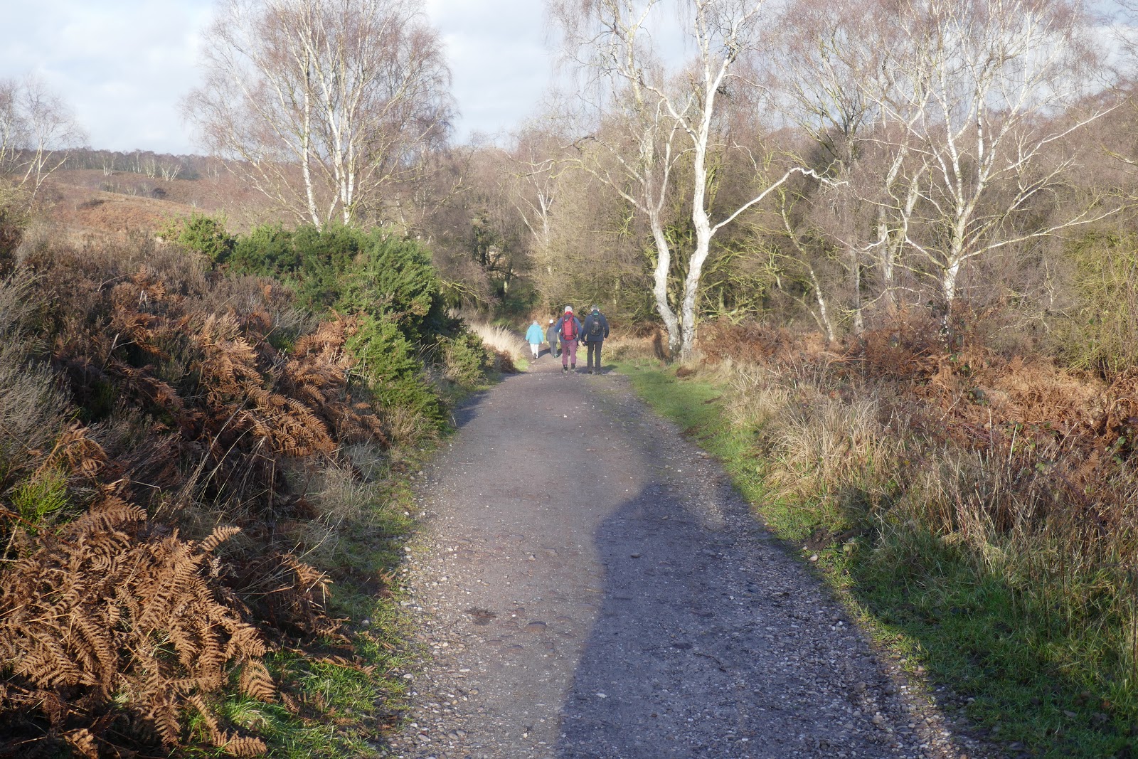
The Desert Highway runs for 350km from Amman to the Saudi border, and apart from our detour via Shobak and Petra, we had followed it all the way. Some 40km short of Aqaba and the Red Sea we turned off towards Wadi Rum.

Towards Wadi Rum

Into Wadi Rum

We checked in at the visitor centre. Every person, every vehicle, every domesticated animal that enters the Wadi Rum Protected Area is logged and the appropriate fee paid.

Once this was done, we headed into the desert. Wadi Rum, the largest wadi in Jordan, is a valley cut by water through sandstone and granite hills. There is still water here, the many wells and springs have supported a local population since prehistoric times.

Into Wadi Rum

Lawrence of Arabia (the 1962 film, not the man) put Wadi Rum firmly on the tourist map, but it is not just a film location, much of the real action also took place here. The Protected Area is tightly controlled to provide revenue for the Jordanian government, to maintain the area for future exploitation, and to protect its unique environment. There is, of course, tension between these goals and there is no significance in the order of my list. We passed several desert camps while driving to our own, and over a dozen more are secreted in rocky corners elsewhere. Maybe there are too many.

Wadi Rum is also known as Wadi al-Qamar (Valley of the Moon) and there is a space theme among the various tourist camps. Ours was actuallly called ‘Space Camp’ though the accommodation was in cabins decked out to vaguely resemble Bedouin tents…

Space Camp, Wadi Rum
Inside our 'tent' Wadi Rum

We had a look round and settled in. Tea and coffee were available in reception – a big tent at the end - but there was no sign of lunch. Fortunately, we had enjoyed a second breakfast, so that was all right - and they were promising a special dinner in the evening.

Touring Wadi Rum

It was not long before a young man turned up in a pick-up truck with our name on it – figuratively, I am not really Mr Toyota - you think I would be bouncing round in the back of one of those if I was?

In our pick-up truck, Wadi Rum

We set off into the red, sandy emptiness of Wadi Rum. Of the three possible derivations of the name the least likely is that it was the site of Iram of the Pillars, a legendary lost city that receives a fleeting mention in the Quran. The ruins at Shisr, a village on the edge of the Empty Quarter in Oman have also been touted by some (particularly the local tourist authorities) as Iram of the Pillars. We visited last year and I am sceptical about that, too. Possibly ‘Rum’ derives from an Arabic word for ‘wind-blown sand’, but my favourite is that it refers to the Romans – ‘Rum’ and ‘Rumi’ often do in the Arabic and Indian worlds. They were certainly here, and commented on the vineyards – those seem to have disappeared!

Wadi Rum

The Martian

I would have been happy just to drive around the valley, but we were in the hands of the tourist industry, and they have to show you ‘sights’, it is in the job description. For the first ‘sight’ we climbed onto a smallish outcrop. It was, undoubtedly, a magnificent view. The guide seemed to expect more, ‘Martian..’ he prompted. I agreed it resembled Mars, reddish and with the tracks of the Mars Rover all over it. ‘The film…’ he went on. ‘What film?’ ‘The Martian, with Matt Damon.’ I am not totally ignorant; I have heard of a film called ‘The Martian’ and of an actor called Matt Damon but I have never seen either. ‘It was filmed here,’ he said. Perhaps I should have looked more impressed.

A view of Mars, Wadi Rum

We continued making tracks in the sand. From a distance we saw a couple crossing the desert the hard way. Not being a film fan makes you out of touch, not old-fashioned, but is it old fashioned to feel uncomfortable seeing a lightly laden young man marching along with his girlfriend/partner/travelling companion struggling behind with a full pack? Maybe there was a reason, I should not judge.

Following a gentleman across the desert, Wadi Rum

The Seven Pillars of Wisdom

A rock formation known as ‘Jabal al-Mazmar’ (Mountain of the Plague) was renamed The Seven Pillars of Wisdom in the 1980s, after Lawrence of Arabia’s book. The renaming was for touristic purposes, Lawrence had no known association with these rocks, but if I was the rocks I would happily forego the ‘plague’ tag. I cannot see seven (maybe from another angle, though this is the side always photographed) and ‘pillars’ is not the first object to come to mind, but they are quite a sight. The 500 million-year-old ‘pillars’ of Palaeozoic quartz sandstone perch on a 4.6 billion-year-old pre-Cambrian granitoid base.

The Seven Pillars of Wisdom, Wadi Rum

Lawrence’s book has appeared in several versions, edited down by himself or others from the original unreadable 400,000 word manuscript. American Academic Charles Hill called it "a novel traveling under the cover of autobiography," Winston Churchill wrote "It ranks with the greatest books ever written in the English language. As a narrative of war and adventure it is unsurpassable." It remains in print (there is a Kindle edition at £0.49) but I am not sure it is much read.

Not Climbing a Dune

Continuing down the valley we pulled up beside several other trucks below what looked like a dune with a view. The passengers from the other trucks were begining their descent, so we set off towards them.

The lower part was steep. In the photograph below it can be seen to drop sharply away just beyond me, and the vehicles are some distance below.

Climbing a rocky outcrop, Wadi Rum. There is a great big clue staring me in the face.

That did not matter; we have climbed dunes before and know that it is best done in bare feet.  The sand was firm which made the steep section easy and we progressed to the top without difficulty. Only when we reached the summit did we realise we had not been climbing a dune – there ae no dunes round here – but a rocky outcrop. On sand, bare feet work well, on a dome of hard rock with sharp ridges and a scattering of stones it is a painfully different story.

The views, though, were as good as we had expected. Wishing she had carried her shoes with her, Lynne gingerly worked her way over to a spot for a photograph….

Lynne on the top of the outcrop, Wadi Rum

….and then we put the camera on a rock for a different view, partly obscured by both of us. …

Obscuring the view. Wadi Rum. Hopping across that stretch of rock before the little light on the camera went off was a challenge

…and then one down the valley. In none of these pictures is there a single dune. Why had we not noticed before setting off?

Looking down Wadi Rum from the top of the outcrop

Nabataean Petroglyphs

A ten-minute drive…

Through Wadi Rum

….through stunning scenery…

Through Wadi Rum

…brought us to a rock face scratched with the images of camels and hunting scenes. Hitherto, apart from the two trucks at the outcrop, we had been on our own, here we encountered the crowds. There are selfish people who climb onto a boulder and painstakingly photograph minute areas of rock in great close up, thus depriving everyone else of a view. Most, though are more reasonable and we eventually had a good look at both areas of drawings at this site. There are said to be 25,000 petroglyphs in Wadi Rum, but counting scratches on a rock face leaves much to interpretation. I think these are Nabataean, they were responsible for most glyphs in the wadi, though some are later, the work of Bedouins.

Nabataean Petroglyphs, Wadi Rum

There is clearly some writing on one area in what is known as Thamudic – a catch-all name for a variety of so far undeciphered scripts found throughout the Arabian region. Elsewhere there are inscription in Kufic, an early Arabic script.

Nabataean petroglyphs with Thamudic inscriptions, Wadi Rum

Barrah Siq and TE Lawrence

Another short journey took us towards Barrah Siq. The sight of two Bedouins leading camels through the desert still manages to be exciting, even when you know they are going to give rides to tourists.

Bedouin leading camels through Wadi Rum

The entrance to the narrow siq is another place where tourists congregate. Allegedly this is where TE Lawrence first met Prince Abdullah, the son of Hussein the Sharif of Mecca. Both appear in rock carvings. Neither are of high quality though Prince Abdullah might have looked something like this...

Prince Abdullah

... while photographs of Lawrence show that he was no Peter O’Toole, but neither was he a moon-faced schoolboy.

TE Lawrence, Barrah Siq, Wadi Rum

The real purpose of the effigies is to drag in the tourists and their money, because behind them are the souvenir sellers and coffee stalls.

The Ottoman Empire entered the First World War on the side of the Central Powers in October 1914. To prevent moves against the Persian oil fields and the Suez Canal, the British and French plotted to turn Arab unrest in the Ottoman south into open revolt. In a series of letters between July 1915 and March 1916 the British and Hussein bin Ali, Sharif of Mecca agreed that Hussein would lead a revolt, bankrolled by Britain and France and aided by the British Egyptian Expeditionary Force. Once it was successful the allies would support the creation of an independent Arab state stretching from Damascus to Yemen.

TE Lawrence, near Jeddah 1917
(photo in Public Domain)

Dozens of British and French officers, including TE Lawrence, were dispatched to liaise with the Arab forces. They fought successfully alongside Hussein’s sons Ali, Abdullah and Faizal.

British history books, at least up to the mid-60s (i.e. the ones I read as I child) presented Lawrence as single-handedly leading the Arab revolt, the subtext being that any group of people can achieve anything provided they are led by an Oxford educated, fair-skinned English gentleman (even if Lawrence’s background was not quite as conventional as we were allowed to assume).

Abdullah when King of Jordan
Photo by Cecil Beaton (in Public domain)

The ludicrous hype of the Lawrence story has obscured the reality of his achievements. He was an academic archaeologist who knew the area well before the war, spoke good Arabic and developed an excellent working relationship with Prince Faizal, Hussain’s eldest son. He was a remarkably effective officer, but not the only one - and he was not superman.

Unfortunately for Lawrence’s reputation among the Arabs, the British and French double-crossed them. The 1916 Sykes-Picot agreement had already carved the region into a series of British and French protectorates, there would be no pan-Arab state.

King Abdulla II of Jordan
Photo from Wikipedia

Hussein’s sons at first did well from the post war arrangements, but none of them prospered for long. Ali succeeded his father as Sharif of Mecca in 1925, but was deposed after 3 months by Ibn Saud who was busy creating Saudi Arabia. Faisal become King of Iraq but died ostensibly of a ‘heart attack’ in 1933. He was succeeded by his son, who died in a mysterious road ‘accident’, and then his grandson who was murdered in the 1958 military coup. Abdullah did best, becoming King of Jordan, but he was assassinated in 1951. He was succeeded briefly by his son Talal who abdicated, grandson Hussein and then great-grandson who has been King Abdullah II since 1999.

Sunset in Wadi Rum

All such tours must end with the sun setting into the desert. Of course, there are chosen places for this and we lined up with the rest. Too often we have watched the sun subside into a low band of cloud, but not this time.

Sunset, Wadi Rum

Having lost my bearings in the desert, I was surprised to find we were watching the sunset from the ridge beside our camp.

Space Camp, Wadi Rum

When we got back it rained, not hard and not for long…

Rain in the desert, Wadi Rum

… but a definite shower. I was shocked, but have since discovered that rain in November is not as rare here as I thought.

Dinner in Wadi Rum

The rain had gone by the time we went to watch our dinner being disinterred.

Disinterring our dinner, Wadi Rum

A traditional Bedouin zarb is cooked in an underground oven called a taboon.

Extracting the zarb from the taboon, Wadi Rum

The heavily bearded and well-fed master of ceremonies explained that the vegetables had been cooked above the meat, so vegetarians could be confident they had not been contaminated.

Zarb dinner, Wadi Rum

All was arranged as a buffet and the camp residents were invited to eat. I would like to say how good it was, but sadly it wasn’t. None of the vegetables were peeled - picking baked onion from its brown, papery outer layer is not a pleasure – and they had all taken on a woolly texture. The meat was bland, too. It would have been better if the meat had been above the veg and the juices allowed to drip through (and maybe this is the traditional way), but vegetarians would then go hungry. This problem has no obvious solution.

Jordan

Part 1: Amman

THE END