Wednesday 13 April 2016

Knowstone to Black Dog on the Two Moors Way: Day 26 of the South West Odyssey (English Branch)

The South West Odyssey was a long distance walk.
Five like-minded people started in 2008 from the Cardingmill Valley in Shropshire and by walking three days a year finished at Start Bay on the South Devon Coast in May 2019.

Devon
The title of this post is not entirely accurate. We did not quite start in Knowstone, nor did we exactly finish in Black Dog, but at farmhouses in the vicinity. We did, though, follow the Two Moors Way all day.

The Day 26 walk in Orange

After a good farmhouse breakfast we left West Bowden, walked back up out of the dip, through the field of spring lambs and turned left onto the minor road heading towards the A361.


Mike, Francis, Brian and Lynne
Ready to set off from West Bowden
My glasses are on a seat just inside the wooden gate over Lynne's left shoulder
After 500m the Two Moors Way detours to find a route under the main road. Thinking it was appropriate to check my map, I found my efforts hampered by lack of glasses. The others waited as I walked as swiftly as I could back to West Bowden. The field of sheep greeted me like an old friend, setting off a tremendous baa-ing, and I was relieved to find my glasses where I thought I had left them. I set off back, still at top speed. When I hit the rise from the farmhouse for the second time that morning I began to feel it and I was breathing heavily by the time I made the road. Despite working hard to give the impression of rapid movement I was definitely slowing long before I re-joined my companions, who were waiting with more patience than I deserved.

Spring lambs, West Bowden

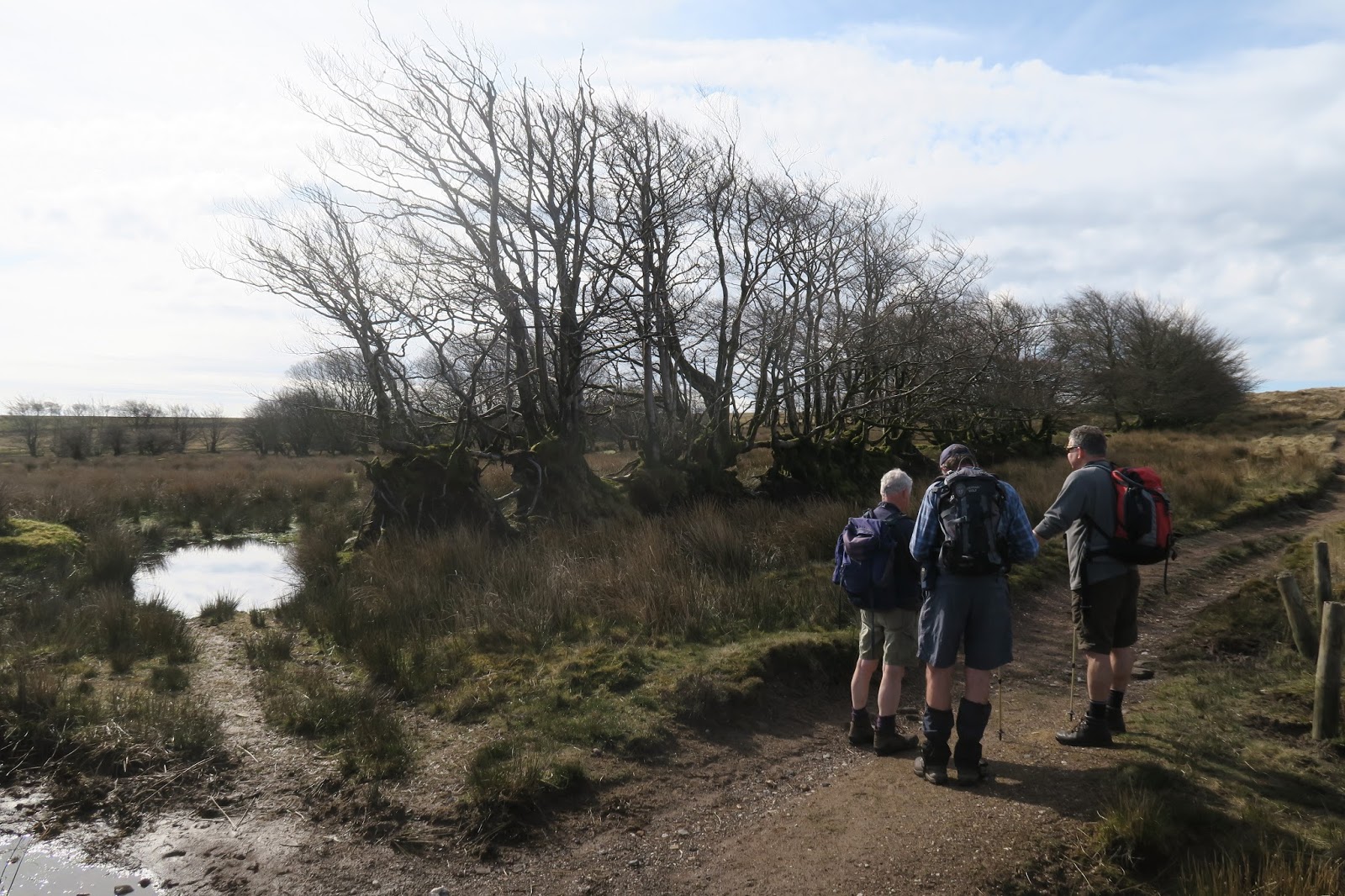
We detoured left and then right down the edge of Knowstone Inner Moor. At first it was a pleasant path….

Along the edge of Knowstone Inner Moor

….. but as it dropped towards the Sturcombe River it became muddier and muddier. Wooden walkways covered some of the worst of it, but there was still plenty to wallow in.

Francis on Knowstone Inner Moor looking like he wishes he was somewhere else
Slipping, sliding and sometimes sinking, we eventually reached a drier path that took us under the A361 and then to the minor road we had driven along to Rackenford last night.

Under the A361

A right turn onto Canworthy Common put us on a green lane. Wide, relatively dry and yielding underfoot, this pleasant path lasted just over a kilometre.


Along the green lane
We emerged onto a minor road. The Two Moors Way involves a lot of road walking, at least between the moors, and we were now in for more than 4km of it. It is unusual to find such a paucity of footpaths in a very rural area.

Road walking has occasional compensations; a short section of the verge was covered in primroses….

Bank of primroses beside the road

 … while Creacomber Cross gave us our first view of Dartmoor, which we will reach next year (if we are spared, as Terry Wogan used to say).

Dartmoor rising in the distance, Creacomber Cross
 At Creacombe Parsonage, we passed the high, dense hedge of the Acorns Naturist Retreat. Somebody used the strangely dated phrase 'nudist colony' and for the next five minutes there was a sorry descent into full Carry On mode; somehow the seventies never died.

Twenty minutes later we paused for coffee leaning on a gate at Crowdhole Cross with a lovely view over the fields down to the Sturcombe River (again). It was, though, a noisy place – those birds never shut up.
Coffee-time view down to the Sturcombe River, somewhere down the bottom there
We slogged on down the apparently endless road,......


Endless minor road, approaching Bradford Barton

...... past Bradford Barton, across the Little Dart River at Bradford Mill and up the hill beyond. Just as it started to steepen we at last turned off to follow a footpath below Bradford Moor Plantation.

Below Bradford Moor Plantation
 Beyond the woods we crossed the slope above the Little Dart, passing its confluence with the Sturcombe.

The slope above the Little Dart River
Approaching a gate in a fence I became aware that Mike appeared to be straddling a sheep. In Wales we call that 'foreplay' but he claimed he was freeing the ewe, disentangling its head from the wire fence. He stuck to his story and for the defence he might point out that he has previous with animal rescue, a lamb hauled from a pit on the Brecon Beacons and the freeing of a string entwined magpie in Somerset spring readily to mind.

We had to sacrifice much of the height gained earlier to cross an unnamed tributary before climbing through Yeo Copse and across the fields to Witheridge.

Up through the Yeo Copse

With just over a thousand inhabitants, Witheridge was by far the biggest settlement we had encountered since Watchet, itself hardly a metropolis.

Witheridge

It was just warm enough to sit outside the Mitre to enjoy a couple of pints of lunch.


A pint of lunch at the Mitre, Witheridge
In Witheridge the Two Moors Way picks its way between the houses then drops across a field to a stream. Like most fields the muddiest section was around the gate.
 
Brian and Mike navigate round the mud

After another 'up' followed by a steep 'down' we reached a footbridge over the River Dalch from where a wooded climb took us up to Washford Pyne.


The climb up to Washford Pyne

The waters of the Dalch, like the Little Dart find their way into the Taw and thence to the north Devon Coast. At yesterday’s start, much further north, we had crossed the Barle, which flows into the Exe and on to the south Devon coast. Tracing the watershed through the deeply folded Devon countryside is not easy.

St Peter’s Church at Washford Pyne looked a handsome building to me. The Devon County Council website quotes from a 1954 book entitled Devon by W.G. Hoskins ‘Washford Pyne church was wholly rebuilt in 1883-7 and is of no interest.’  Ah well.

St Peter's, Washwood Pyne
The pattern of ups and downs continued. From Washford Pyne the path through Washford Wood started level,…

Through Washford Wood

… but soon descended to a stream,….

The bridge at the bottom of Washford Wood
….. then it was up and over, and repeat, to the hamlet of Lower Black Dog.
Lower Black Dog
The village of Black Dog was a few hundred metres to our east, but we would return there in the evening to dine at the pub, unsurprisingly called the Black Dog Inn.

Black Dog lies on the highest ridge between Exmoor and Dartmoor, giving views of both moors at once. We passed through Blue Anchor on the Somerset coast last year, and this may well be another case of a village taking its name from its pub. Black Dog grew up round a well and a story tells of how the tunnel running from the well to Berry Castle, an earthwork a mile to the south, was once guarded by a ghostly black dog. Sadly, no such tunnel ever existed and the story sounds suspiciously like a later invention to explain a name already in use.

The undulations continued, as we first walked west then south to our B&B. There were no great heights to scale, the ridge at Black Dog is a little over 200m, but between the ridges the path had a way of dropping quite steeply and then, at what should be the bottom of the valley, there was a further descent to the stream itself which had spent several millennia digging itself deeper and deeper into its bed.

About to drop down to the next stream

On one of the high points we passed an isolated barn containing the remains of a threshing machine that had once been dragged from farm to farm behind a traction engine. Several years' restoration work was available for an enthusiast, but I would not know where to start. Mike gave one of the wheels an exploratory turn, and it moved surprisingly easily. That was when the pigeons nesting inside decided to complain.

Mike inspects the remains of a steam powered threshing machine

By the time we had finished examining it, Francis was dwindling into the distance on the way down to the next stream.

Francis dwindles into the distance

We reached the B&B, an isolated farmhouse, about 4.30. The farmyard was something of a contrast to the neat and orderly world of West Bowden Farm the previous evening.

Our stay with Brian and Hilary in Torquay last week had provided an insight into the worlds of collecting and hoarding. Brian is, among other things, a walker while Hilary is a collector. She likes to cover every surface with objets d'art, mainly of far eastern origin, many of very high quality. Together we had visited Greenway, the former home of Agatha Christie. Christie and her daughter also filled their house, perhaps over-enthusiastically. The National Trust have kept it as it was, perched on the cusp between collecting and hoarding. Tonight's friendly landlady had no truck with ‘the cusp,’ she was a confirmed hoarder; you always had to move something to sit down.

The welcome was warm and genuine, but she was elderly so it did not include twenty-first century ‘necessities’ like Wi-Fi, nor indeed late twentieth century ‘necessities’ like mobile phone signals, en suite bathrooms, televisions, tea making equipment or even heating. 'I don’t light the wood burners because there's jackdaws nesting in the chimneys and I don't like to disturb them.' Our stay was appropriately inexpensive, but I suspect she was in business more for company than the money.

Later Brian nobly drove us back to the similarly welcoming but more up to date (free Wi-Fi) Black Dog for a pleasant evening involving food and beer – two of my favourites.


The South West Odyssey (English Branch)

Tuesday 12 April 2016

Entering Devon and Leaving Exmoor (in that order) : Day 25 of the South West Odyssey (English Branch)

The South West Odyssey was a long distance walk.
Five like-minded people started in 2008 from the Cardingmill Valley in Shropshire and by walking three days a year finished at Start Bay on the South Devon Coast in May 2019
.

South Across Exmoor from Withypool and on Towards Dartmoor

Return to Withypool

Somerset

This year's instalment started with a disappointment. Alison, who has been ever-present on this and previous walks that have taken us among other places, from Hadrian's Wall (see Intro) to Exmoor was missing. A domestic crisis cropped up two days before the start of the walk and she understandably felt this was not a time to be away. She was missed and I hope her absence is only temporary.

The surviving four walkers, and Lynne, who provides the essential logistical support gathered on Monday at the Royal Oak in Withypool where last year's walk finished. Proceedings kicked off with a good dinner.

Dinner in the Royal Oak, Withypool

In the morning we gathered for a photo outside the Royal Oak, standing in the middle of Withypool's main street – not as dangerous as it sounds.

Francis, Brian, Mike and Me
Outside the Royal Oak, Withypool - or is it a poster for a bad cop film

Withypool to Dane's Brook

We walked through the village, down past the tea rooms whose cream tea featured at the end of last year’s walk, over the Barle Bridge and up the hill beyond.

Bridge over the River Barle, Withypool

Why Mike chose to run up this road is a mystery, but he kept a up steady pace far longer than I would have thought reasonable - or possible – even if he did flag a little before the top.

Leaving Withypool

A hundred metres beyond the houses we turned onto a track across the moorland. It was a lovely surface to walk on, dry and springy after recent good weather.

Onto the open moor, Exmoor

The gradient was gentle and the path soon bought us tangentially to the ‘main’ road from Withypool where we swung away south. We swung a little early, following a narrow track, probably made by ponies (or Land Rovers), and missing the wider path hiding in the grass just a few metres away.

This might be the moment Mike spotted the wider path

We seemed to correct ourselves one by one, but we were all on the wider path by the time we reached Tudball's Splats. This splendidly named location is apparently known locally as 'Four Fields' which may be prosaic, but accurately describes the almost rectangular fields marked out on the moorland long ago. ‘Tudball’ is believed to be a Somerset mangling of ‘Theobald’, but who Theobald was nobody knows. The English Dialect Dictionary (pub. 1898-1905) defines 'Splat(t)' or 'Splot(t)' as a plot or little piece of ground. The word was recorded in Devon in 963 and according to the EDD remained in use in Cornwall, Devon and Somerset- we passed a Splatts barn in 2012 (Day 14, North Nibley to Old Sodbury) in Gloucestershire (though only 5 or 6 km outside Somerset).

Tudball's Splats behind the grown out hedge, Exmoor

Crossing the moor Francis and Brian observed and confidently identified stonechat, chiffchaff, willow warbler, meadow pipit, marsh tit and kestrel. We all spotted the first swallow of spring and the circling buzzards and heard and saw a plethora of skylarks.

Less than 10 minutes from Tudball’s Splats is the Porchester Post. As we discovered last year this part of Somerset is full of useful posts telling you exactly where you are in the middle of nowhere. Lord Porchester is the title of the Earl of Carnarvon's eldest son before he inherits the earldom and this particular post was originally erected in 1796 by the Carnarvon family of Highclere Castle (better known as Downton Abbey) to mark the boundary between Withypool and the parish of Hawkridge which they had recently acquired from the Aclands - whom we encountered last year. The piece of wood in the photo is not particularly old – the post has been replaced many times.

The Porchester Post, Exmoor

Over Dane's Brook and into Devon

Devon

A little further along, Upper Willingford Bridge over the tiny Dane's Brook is of little significance as a bridge, but it marks the point where we left Somerset, through which we have been walking since 2013, and entered Devon the fifth and last county in this walk (though the precise end point remains a matter for conjecture).

Dane's Brook flowing under the Upper Willingford Bridge, Exmoor

Encroaching farmland has left only a thin neck of moorland here but beyond the bridge it opens into the larger areas of Molland and Anstey Commons. We crossed a small corner of this moorland to White Post, which is, believe or not, a white post – and also a perfectly ordinary road sign where two minor roads reach the moor.

We paused here for coffee and to consider our next move. The route Francis had chosen while sitting in the comfort of home involved setting out across Molland Common just to the right of the high point then swinging right to find a ford back across Dane's Brook.

Coffee at White Post, Exmoor

It looked fine sitting at a desk in Stafford, but less good perched on a bench on Exmoor. Although a path theoretically existed there was no sign of it on the ground, the high point was a barely discernible bump and the map was covered with those little green tussocks that indicate marshland.

Carver Doone, the villain of Lorna Doone, drowned in a bog on Exmoor and although we would have been unlikely to suffer the same fate, crossing an area called 'Soaky Moor' seemed unappealing. We would be better off, we decided, walking a kilometre along the road following the edge of the moor and then, hopefully, locating a path leading down the edge of Triss Combe.

Down Triss Combe and off the Moor to Molland

The path along the top of the combe was easy to find, though a little churned up and muddied by the resident ponies.

The path beside Triss Combe which drops away to the left

Exmoor ponies have lived semi-feral on the moor for a very long time. The local belief that they have been pure bred since the ice age is unverified, bur fossil records dating from 50,000 years ago show that local horses have changed little. They almost became extinct after the Second World War and are still threatened with only 500 in Britain, mainly on Exmoor, and another 300 elsewhere.

Exmoor Ponies

Our descent of the combe eventually picked up a farm track at which point we crossed the southern boundary of the Exmoor National Park. Following the track, we regained the planned route just west of Smallacombe Farm. From here field paths took us down to a small, unnamed stream and up the other side.....

Down to a nameless stream nearing Molland

....from where we descended across the fields to Molland.

Over the fields to Molland

Molland and the London Inn

Molland has a population of 200, half what it was in 1900. It has a large 15th century church and, remarkably for a small and remote village, a fully functioning pub. The 16th century London Inn proved welcoming and provided us with a very decent glass or two of lunch. The morning had started cool and April sunshine takes a while to build up much warmth but as the morning had progressed outer clothing had been shed and it was now balmy enough to sit outside the pub. The sign suggested it had once been a coaching inn while the name hinted that passengers were en route for London. I am no expert in old coaching routes but I suspect any coach bound for London that found itself in Molland was seriously lost. I would, though, congratulate all those concerned with keeping the pub open when so many have closed and I hope their promised new website will give some historical information. [Update June 2022: The promised website came and went, but the pub remains open when so many have closed. For that three hearty cheers.]

Day 25 of the South West Odyssey

Molland to Knowstone

Our approach to Molland, descent to a stream followed by a sharp incline established a pattern that would become familiar over the next two days.

Down through Bond Wood

Climbing the low hill south of the village allowed us to descend steadily through Bond Wood to re-cross the nameless stream we had encountered earlier. The stiff climb up the other side eventually provided a good view back to Molland.

Looking back to Molland

Soon after, we joined a minor road, the start of some 4km of road walking broken only by a brief shortcut contouring through Middle Lee and East Lee farms. Most of this flat stretch involved walking east with the sun on our right shoulders. Roads might be hard on the feet, but the weather could not have been better.

For the final kilometre we turned south, joining the Two Moors Way, a 166km long footpath crossing Dartmoor, Exmoor and the land between. It is usually described as stretching ‘from Ivybridge in South Devon to Lynmouth on the north coast’ inferring most walkers travel south to north. We were going the other way, which several locals told us was odd, if not downright perverse – so why did we encountered so few walkers coming the other way?

Francis checks the map

We crossed the River Yeo, one of eleven rivers of that name in Devon and Somerset, and not the most important of them.

Near Yeo Mill

From the bridge we climbed gently upwards to the end of the road. The next two kilometres crossed Easter New Moor and Owlaborough Moor, which despite their names, are level(ish) farmland rather than moorland, ending with a wooded descent to the hamlet of Owlaborough.

Wooded descent into Owlaborough

I regret not having a picture of Owlaborough’s unusual small circular barn. According to a local, very possibly the owner, until a little over a hundred years ago a horse plodding round in circles in this barn providing the motive power for the threshing machine next door.

Back on a minor road we descended to a bridge over a stream called The Crooked Oak, then climbed up to the village of Knowstone, the nearest settlement to West Bowden Farm, our B &B for the night. We had been advised that if we wanted to eat in the Mason's Arms we would need to book, which Francis had duly done. This morning the landlord of the Royal Oak in Withypool had casual mentioned that the Mason’s Arms was a Michelin starred restaurant.

The Mason's Arms (thatched building set back from the road), Knowstone

We paused to read the menu, which read very nicely as you would expect. It also involved big numbers. I am not averse to a little fine dining - Lynne and I enjoy an annual wedding anniversary excursion into that world, as this blog will witness (click on the Fine Dining label on the right). This, though, was a walk, and walks demand simple, hearty fare at simple, hearty prices.

To West Bowden Farm and Dinner at The Stag in Rackenford

We followed the Two Moors Way through Knowstone and down the minor road towards the A361, turning off after a kilometre onto the farm track leading to West Bowden. We crossed a field of spring lambs...

Spring lambs, West Bowden Farm

...then after 200m the path dropped sharply to the farmhouse.

Down to the farmhouse, West Bowden Farm

We pass through many farmyards in these walks. Their extraordinarily variable state tells you something about the quality of the farmer and West Bowden was as clean and tidy a farmyard as I have seen. Geese patrolled conscientiously while unstressed cattle lounged in clean straw in their pen and ducks swam quackily on the pond.

Brian inspects the ducks, West Bowden Farm

Installed in the B&B Mike found his smart phone had a signal – a rare luxury in rural Devon - so after phoning the Stag Inn in the larger but slightly more distant village of Rackenford to check they had room for us, he called the Mason's Arms to cancel our booking, a task he accomplished with impressive tact.

The Stag Inn is very much a village local. It claims to be the oldest pub in Devon, and its menu provided the required hearty fare. The pub was rescued last year by landlady Anita Singh and chef Mike Horne. On the evidence of one evening they appear to be doing an excellent job. [Update April 2018. Sadly, The Stag closed in September 2016, but was sold and reopened in 2017 and is now a 'gastropub']

The South West Odyssey (English Branch)
Introduction
Day 1 to 3 (2008) Cardingmill Valley to Great Whitley
Day 4 to 6 (2009) Great Whitely to Upton-on-Severn via the Malvern Ridge
Day 7 to 9 (2010) Upton-on-Severn to Andoversford
Day 10 (2011) Andoversford to Perrott's Brook
Day 11 (2011) Perrott's Brook to the Round Elm Crossroads
Day 12 (2011) Walking Round Stroud
Day 13 (2012) Stroud to North Nibley
Day 14 (2012) North Nibley to Old Sodbury
Day 15 (2012) Old Sodbury to Swineford
Day 16 (2013) Along the Chew Valley
Day 17 (2013) Over the Mendips to Wells
Day 18 (2013) Wells to Glastonbury 'The Mountain Route'
Day 19 (2014) Glastonbury to Langport
Day 20 (2014) Along the Parrett and over the Tone
Day 21 (2014) Into the Quantocks
Day 22 (2015) From the Quantocks to the Sea
Day 23 (2015) Watchet, Dunster and Dunkery Hill
Day 24 (2015) Dunkery Beacon to Withypool
Day 25 (2016) Entering Devon and Leaving Exmoor
Day 26 (2016) Knowstone to Black Dog on the Two Moors Way
Day 27 (2016) Morchard Bishop to Copplestone
Day 28 (2017) Down St Mary to Drewsteignton
Day 29 (2017) Drewsteignton to Bennett's Cross
Day 30 (2017) Bennett's Cross to Lustleigh
Day 31 (2018) Southwest Across the Moor from Lustleigh
Day 32 (2018) South to Ugborough
Day 33 (2018) Ugborough to Ringmore
Day 34 (2019) Around the Avon Estuary to Hope Cove
Day 35 (2019):  Hope Cove to Prawle Point
Day 36 (2019) Prawle Point to Start Bay: The End
+
The Last Post

That's All Folks - The Odyssey is done.