Wednesday 25 April 2018

South to Ugborough: Day 32 of the South West Odyssey (English Branch)

The South West Odyssey was a long distance walk.
Five like-minded people started in 2008 from the Cardingmill Valley in Shropshire and by walking three days a year finished at Start Bay on the South Devon Coast in May 2019.

Devon
Last night's renewed confidence was bolstered by a good night's sleep and I discovered I was moving fairly easily when, bright and early, I followed Brian to Ugborough to drive him back after he had parked his car at the end of today’s walk.

Day 32 (in yellow)
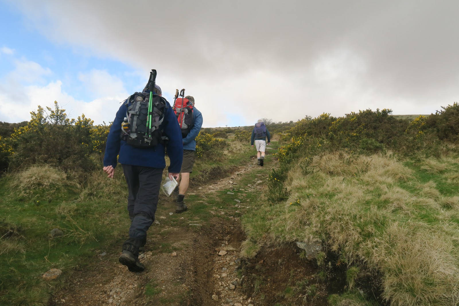
After breakfast Mike took us back to the lane between Cross Furzes and Lud Gate where we finished yesterday. We walked to Lud Gate and onto the open moor.

Walking to Lud Gate
For the second day running we started high (305m) but almost immediately had to climb higher. I was not particularly quick up Hickerton Hill (420m), but not desperately slow either and it felt a lot less brutal than yesterday's opening salvo.

Up Hickerton Hill from Lud Gate
The view from the top was of moorland stretching as far as the eye could see.

There is plenty of moorland!
Yesterday, I failed to mention the skylarks over Haytor Down; they were here too, their fluttering song softening the moor’s austere beauty. This is a landscape formed by nature, by the soil and rocks and the cool, damp maritime climate. It is also a landscape formed by people, we would shortly encounter the remains of recent activity while medieval crosses and boundary markers are everywhere and on the hillside opposite were hut circles and Huntingdon Barrow (less prosaically known as the 'Heap of Sinners'), built by the region's earliest inhabitants.

Ancient Settlement on Huntingdon Warren
From the summit, as we picked our way through the mire towards Western Wella Brook...

Descending towards Western Wella Brook
... we passed what at first I took for a ruined dwelling, but it was far too narrow – and full of water. Mike suggested it might have housed a waterwheel; Richard Knghts’ excellent Dartmoor Walks  confirms that, identifying it as the only easily visible remains of Wheal Vor, a tin mine that closed in 1815.

Waterwheel pit from Devon Wheal Vor tin mine
We had strayed too far to the right and reached the brook north of the crossing point. A long step from the bank to a tall, flat topped stone and then another to the far side were enough for Brian and Mike. Those of us blessed with shorter legs continued downstream through a land in aqueous solution.

Alison following the West Wella Brook
(the brook is actually 30m to her right, but detours were necessary to get round the boggier sections) 
The map shows a ford just above the confluence with the River Avon, and here the stream is wider and shallower though it is not an easy crossing if you want to keep your feet dry. Undoubtedly my passage was inelegant and wobbly, but as I couldn't photograph myself, here is Alison.

Alison crossing the West Wella Brook
Huntingdon Cross is near the ford. Originally it was a waymarker on the Abbot’s Way, a route between Buckfast Abbey to the south and the abbeys of Tavistock and Buckland to the north, but after the dissolution of Buckfast Abbey in 1539 it was commandeered by Sir William Petre, Henry VIII’s Secretary of State, to be a boundary marker of his vast estates – which now included the former Abbey lands. Sir William served Edward VI, Mary I and Elizabeth I in the same capacity, dextrously hopping backwards and forwards between Catholicism and Protestantism. You have to admire his agility, if not his integrity.

Huntingdon Cross, 
We followed the Avon upstream. There is a ford and Francis left the path to check it out but deemed it better to detour a short way upstream to the Huntingdon Warren clapper bridge.
.
The (Devon) River Avon
Clapper bridges are a feature of Dartmoor and Exmoor but this was the first on this walk, and it was a splendid bridge on which to cross the third Avon of the Odyssey, after the Warwickshire (Shakespeare's) Avon in 2010 (Day 7) and the Bristol Avon in 2013 (Day 16). We shall leave England's two other Avons, both in Hampshire, uncrossed.

We all crossed to the far side, then returned as it was eleven o'clock and there were better places to sit for coffee on the near side. It was the sort of bridge I was happy to walk across twice, and again so I could pose in the middle for a photo. And I wasn't the only one.

Francis & me on the Huntingdon Warren clapper bridge over the (Devon) Avon (photo: Alison)
It was thought that clapper bridges were ancient, but most are medieval and, like this one, associated with a nearby ford, from which the word ‘clapper’ is probably derived via Latin or Anglo-Saxon.

From here the Two Moors Way makes a lengthy detour contouring round the end of Western White Barrow but it was much shorter to go straight over its 480m summit. We had hardly left the bridge when the rain started, first as drizzle but getting steadily harder.

As we started to climb I paused to put on my allegedly waterproof jacket over my genuinely showerproof coat then got down to a slow but steady upward plod. There have not been many (any?) climbs where I have reached the top before Francis, so this may have been a first. When Mike and I passed him, he was sitting in the long, sodden grass in sluicing rain struggling into a pair of over-trousers. All three of us were wearing shorts, but skin dries quickly, so why bother covering it?

Francis had nearly caught us up by the time we had reached Petre's Cross (him again) on the summit. Below us was a disused tramway, and below that, in the valley, another tramway snaked into the distance following the contours between the hills.

Petre's Cross on Western White Barrow
We made our way to the first tramway, walked along it briefly and then picked a spot to descend to the second. The boggy ground made watching your feet at every step essential. And then the rain turned into hail, which stung a bit.

Boggy ground on Western White Barrow
The attraction of the tramway for me was its flatness, I can keep up on the flat, but what made it an absolute winner (and the Two Moors Way follows the same route) is its relative dryness. Nothing on the moor is absolutely dry, the tramway had flooded sections to detour round, but the risk of sinking up to your knees in mud was minimal.

Along the Red Lake Tramway
Unlike the Haytor Granite Tramway yesterday, The Redlake Tramway, for such this was, was an 8 mile long narrow-gauge railway built in 1911 to haul china clay from the moor to the main line near Bittaford. Operations finished in 1932 and it was subsequently dismantled.

It took longer than I expected to cover the first two kilometres to Left Lake. Despite appearances the lake on the left of my photo is not Left Lake, in fact it's not a lake at all, it is a pond created by the removal of china clay. The Left Lake is actually the steam which drains Left Lake Mire (and now the pond as well) flowing beneath the tramway to the infant River Erme. We had joined the Redlake Tramway well south of the Red Lake, which is also, perversely, a steam, though there is now also a pool for the same reason.

The lake on the left is not the left lake at Left Lake (I hope that is clear)
We strode on, the rain long gone, contouring between the hills. Alison looked at her map 'That's Sharp Tor,' she said pointing at a protuberance ahead of us. She was a little behind Francis and on his deaf ear and it was with perfect, if inadvertent, comic timing that Francis immediately pointed at the same hill and said 'That's Three Barrows'.

In due course we stopped for a lunchless lunch break. The landscape changes slowly when walking between the hills but the path itself is almost featureless and can be confusing. The consensus was that the hill ahead was Piles Hill but Mike spotted a distinctive triangular forest down to our right which meant it must be Ugborough Beacon and we were a kilometre further on than we thought.

Looking beyond the wood, we caught a first glimpse of the sea, a large inlet which we identified as the Tamar estuary at Plymouth, though the city remained hidden.

We had been on the tramway for over five kilometres, but before the beacon, at a place marked by the medieval Spurrell's Cross the tramway swung right, round the eastern side of Butterdon Hill while we would bore left to pass between Butterdon Hill and Ugborough Beacon.

Leaving the tramway to walk round Ugborough Beacon
We passed through burnt gorse on the side of the beacon. The burning may have been the result of a wild fire or management of the moor, but what surprised me was that anything here had ever been dry enough to burn.

Burnt gorse on the flank of Ugborough Beacon
We descended the southern flank of Ugborough Beacon, the first serious contours we had encountered for some time, to Wrangaton golf course.

Down to Wrangaton Golf Course
Here we left the moor for the final time and entered the South Hams. A field path and lane taking us past Moorhaven Village.

Plymouth Asylum opened in 1891, built in response to the 1890 Lunacy Act. The complex grew and developed, becoming Moorhaven Mental Hospital before closing in the 1980s. Redeveloped as Moorhaven Village, a housing complex with communal gardens and sports facilities, this once grim Victorian institution is now a desirable place to live.
Moorhaven Village
Moorhaven is immediately north of Bittaford, a large village with a functioning and open pub, the first since Lustleigh last year, so we took advantage of the situation (well, why not? Ugborough was only two kilometres away). There had been no rain for several hours, but as we pushed open the door of the Horse and Groom it started spitting, as we drank it became torrential and by the time we had finished, so had the rain.

Bittaford is at a height of 130m, Ugborough is slightly lower so it could have been a gentle end to the day, but Devon is not like that. From Bittaford we made way down to and under the A38 and then descended further to cross the Lud Brook at 80m. From here Ugborough was on the other side of a ridge that rose to 150m, definitely a sting in the tail, but not on the scale of yesterday's.


Looking back at Bittaford from the top of the grassy section
The initial climb up a grassy field was steep, but then we hit a minor road which rose gently to Toby Cross before descending into Ugborough.


Garden on the edge of Ugborough (pity it was bin day!)
Despite its unfortunate name, acquired from once being the fortified homestead of a Saxon called Ugga (what were his parents thinking?) Ugborough is a pleasant village with a large 12th century church (in poor condition inside, Lynne tells me) and a market square still used for markets, but on the days we needed it fortunately performing the function of car park.


Ugborough Market Square
Unlike yesterday I finished if not fresh, at least still feeling human. Brian drove us to our new B&B, up the hill on the other side of Ugborough giving a preview of tomorrow's taxing start.

We stayed just outside the small town of Modbury (did they once have fights with Rockerbury?)and ventured into town to dine on pub fare at the Modbury Inn. Some also had a pint our two of Jail Ale from the Dartmoor brewery at Princetown a stone's throw from the prison. Brian and Francis rate it very highly, so I will finish this report with a controversial statement. I do not understand what the fuss is about, I would be just as happy with a pint of the very similar Doom Bar - though the fabulously hoppy Proper Job, is, for me, the pick of the beers we've encountered in the south west.


The Modbury Inn, Modbury


The South West Odyssey (English Branch)

Tuesday 24 April 2018

Southwest Across the Moor from Lustleigh: Day 31 of the South West Odyssey (English Branch)

The South West Odyssey was a long distance walk.
Five like-minded people started in 2008 from the Cardingmill Valley in Shropshire and by walking three days a year finished at Start Bay on the South Devon Coast in May 2019.


Devon
Devon is a long way from home for four of us (Brian lives in Torquay) so Lynne (sherpa, tourist and non-walker), Francis, Alison, Mike and I went down on Monday and kicked off proceedings with dinner in the Abbey Inn, Buckfast.

(l to r) Francis, Mike, Alison, Lynne and me, Abbey Inn, Buckfast
Injuries and mishaps meant that this was the first time for three years that all five of us had walked together, so it was with a sense of optimism that we pulled on our boots in the car park on Trendlebere Down, on the edge of the moor above Lustleigh.

Boots on in the car park above Lustleigh
Day 31 of the Odyssey would take us from here, southwest across Dartmoor to Mike’s car, positioned before breakfast beside a tiny road 5km west of Buckfast.

Odyssey Day 31, ending at a nameless spot on a tiny road
Last year had finished in Lustleigh village after a steep and treacherous descent that nobody fancied doing in the upward direction, but on the way the walk had passed through this car park, so it was within the rules and spirit of the Odyssey to start from here.

Despite being well above the village, the morning would commence with a stiff climb. Black Hill (412m) filled most of the western horizon, its summit 200m above the car park.

We set off towards a nearby spur, which looked suspiciously like another summit…

Following Francis and Alison up the first spur
…. but from the top the view of Black Hill looked exactly like the view of the spur fifteen minutes earlier. The ground was remarkably dry, but the day was cool, the wind biting, with mist and rain closing in from the west.

Black Hill from the top of the first spur
It was a brutal start to the day, but it warmed me up as I tailed off behind the others, and then kept everybody waiting at the top while I adjusted boot and sock – my right heel was rubbing and I really did not want a blister on day 1.

From the summit the ground dropped little as we crossed Haytor Down aiming to the right of the prominent Haytor Rocks. We met a small group of Dartmoor ponies who kindly agreed to pose with the rocks as a backdrop.

Dartmoor ponies with Haytor rocks in the mist behind
It would have been a good picture but for the steadily thickening mist.

600m before Haytor Rocks we crossed the Haytor Tramway. These granite tracks were laid in 1820 to guide the flangeless iron wheels of horse-drawn trucks carrying granite from three quarries on the moor to Ventiford 16km away on the Stover canal whence it was barged to Teignmouth for export. Trains of 12 trucks were dragged up to the moor by teams of 18 horses and guided to the appropriate quarry by points. The tramway was graded so that loaded wagons could safely make the descent under gravity. The Stover canal, originally built to carry clay, was the work of James Templer, and his son George constructed the tramway, a time-consuming and expensive task, but presumably worth it as he had just won the contract to supply granite for the new London Bridge (the one now in Arizona). Haytor granite also features prominently in the British Museum and National Gallery, but although the quarries employed 100 men in 1850, they closed in 1858, unable to compete with cheaper Cornish granite.

Points on the Haytor Granite Tramway.
Francis seems to be signalling us to Hollwell quarry, but we followed the other branch round Haytor.
Passing to the right and below Haytor Rocks we made our way through mist and drizzle towards Saddle Tor, pausing to drink our coffee in the shelter of its rocks. In this wintry setting we heard the first cuckoo of spring, a promise of better things to come.

In the lee of the rocks, Saddle Tor
Our route took us down to the B3387 which we followed for a few hundred metres to Hemsworthy Gate (just a spot on the map, there is no actual 'gate') where a small road comes in from the south. The plan was to walk at an angle between the two roads across Blackslade Mire.

Down towards the B3387 with Top Tor in the background
If Haytor Down had been surprisingly dry, Blackslade Mire lived up to its name. With no path extant, trying to follow a compass bearing in 50m visibility with frequent bog-related detours felt foolhardy; better, we thought, to cut back to the smaller road, follow it south for a couple of kilometres to where the map promised a westward path.

Alison disappears into the mist
Along the way we paused at the aptly named Cold East Cross (it was cold, there was a small crossroads and it was undoubtedly east of somewhere) the southernmost point on that side of the map. Opening out an OS map, turning it over and re-folding it the way you want it can be challenging in your living room, doing it at a windswept, rain bespattered cross roads takes skill and perseverance.

Turning the map at Cold East Cross
As Francis and Brian persevered (skilfully) a Range Rover came down the lane. The window wound down, 'Do you know where you are?' asked a voice from the warm, dry interior. Had she asked if we knew why we were there it might have provoked a philosophical discussion, but as we were at a cross roads, were in possession of a map (it was being waved like a flag) and had too much grey hair to be mistaken for callow youths, she came across as rather patronising. Still, she meant well, so we politely informed her we did.

The path heading west was pleasingly obvious and soon became a green lane and then a farm track before joining a minor road south…

The green lane westward
… to the hamlet of Buckland in the Moor where we took a break on a roadside bench.

Lunch stop, Buckland in the Moor
St Peter's Church is a little fifteenth century gem. I lacked the energy to detour inside, but it reputedly has a Norman font and an impressive rood screen.

St Peter's Buckland in the Moor, in the mist
Buckland had 94 inhabitants according to the 2001 census, but apart from the church we saw no dwellings other than a handsome thatched house, though the manorial Buckland Hall hides in the woods nearby.

Thatched house, Buckland in the Moor
Continuing south the road dropped steeply through a forest into the Dart Valley, a painful descent for those with arthritic knees. My eye was attracted by the rich green of the moss on an old wall.

Mossy wall south of Buckland in the Moor
In this damp environment mosses and lichens thrive. Decades ago, when I was a Boy Scout, I learned that you could tell which way was west from the moss on the trees, which grows on the side of the prevailing winds (and of course rains) - a piece of information I have never had cause to use or even check for veracity. I have now, and it works - though I still never expect to use it.

Advice from the epiphytes, West is to the right
At the bottom the road swung right at a farmhouse…

Reaching the bottom of the Dart Valley
…and continued to Buckland Bridge, a little bridge built by public subscription in the 1780s to replace a 16th century construction. It still carries the limited motor traffic that comes this way over the little River Webburn which bounds exuberantly down from the moor.

Buckland Bridge (Picture: Francis)
Within sight of the bridge the Webburn joins the Dart, here impersonating a mature, sensible sort of river.

The confluence of the Webburn (left) and the Dart
Leaving the road, we followed the wide grassy bank of the Dart passing a school party. Francis, ahead as usual, spotted a mandarin duck, floating along with two mallards. When everyone else arrived there were only two mallards, where the Mandarin went was a mystery - but if Francis said it was there, it probably was.

Alison beside the River Dart - while Alison was looking left, the Mandarin duck was round to her right
A kilometre later, at New Bridge, we found a car park, empty but for an ice cream van – they know telepathically when a school party is approaching, but it is not just kids they capture, Francis and Alison could not resist the lure of ice cream. We crossed the New Bridge, which was indeed 'new' in 1415, and walked through the woods on the other side of the river.

New Bridge on the River Dart, I know because the sign says so.
Just before Horseshoe Falls (impressively horseshoe-shaped, but not much of a Falls) the path starts to rise away from the stream to the village of Holne, a kilometre from New Bridge and 100m above it.

The Horseshoe Falls on the River Dart (Niagara has nothing to be frightened about)
I struggled on the long drag up to Holne. We saw little of the village except the sad sight of its closed pub before starting the descent to Scorriton, during which we lost most of the height we had just gained. The descent hurt my knees and I was as slow on that as the climb into Holne. The others kindly waited for me.

Scorriton felt like a village at the bottom of a hole, but at least it's pub still functions - though it closes at 2.30 - an hour before we arrived.

The descent to Scorriton, I think, but I was losing the plot by this stage
Mike’s car was parked on the ridge from Cross Furzes to Lud Gate, at a height of just over 300m. To add insult to injury we took the only road out of Scorriton that actually descends as we headed for Combe to cross the little River Mardle and ensure the last kilometre and a half involved a climb of over 200m.

The River Mardle at Combe
The climb, up through a wood and then across open fields, was a nasty sting in the tail. I had struggled on the climb up to Hohne, and if there was a way of getting out of this climb I would have, but short of lying down in the woods and expiring it could not be avoided. I am grateful to those who waited patiently for me at various points and to those who hung back to walk with me as I plodded slowly upwards.

The wooded part of the final ascent - it was steeper than the camera makes it look, honest
I disliked holding my companions up (though everyone was very gracious), but the climb had to be done, and slowly was all I could manage. Long before the end I had serious doubts about tomorrow's walk. I was under-prepared, my knees are in a bad way, I am overweight - though no more than when this walk started in 2008, but I am ten years older.

Eventually it ended and others walked while I plodded along the lane to Mike's car.

Along the lane to Mike's car
Back at the B&B, I spent an hour lying motionless on my bed, occasionally groaning piteously (and not just for Lynne's sympathy). Then I felt strong enough to have a shower, and the hot water trickling down my body (it wasn't one of the great showers) made me feel strong enough to head for the pub. I ordered a J2O, which raised some eyebrows, but when I finished that I felt strong enough for a pint of Proper Job.

I felt even stronger after that and ate a proper dinner, with a glass or three of Chilean Merlot. And a dessert. Tomorrow? Bring it on! (but my apologies when I again keeping everyone waiting).


The South West Odyssey (English Branch)